Urban UAV Navigation and Communication Market Size & Growth Forecast 2027–2036, By Segments (Component, End-users, Level of Autonomy, Range, Application), Regional Demand Trends (North America, Asia Pacific, Europe), Key Country Insights (U.S., Japan, South Korea, Germany, France, Italy), and Competitive Landscape
Market Size and Growoth Outlook
Urban UAV Navigation and Communication Market size was more than USD 10.34 Billion in 2026 and is set to grow at 17.68% CAGR between 2027 and 2036, surpassing USD 52.67 Billion by 2036. The industry revenue for 2027 is estimated at USD 11.92 Billion.
Get more details on this report
Request Free Sample ReportUrban UAV Navigation and Communication Market Intelligence Snapshot
Regional Market Dynamics
- North America held a 39.96% share in 2026, supported by advanced UAV infrastructure, autonomous technology investment, expanding urban applications, and evolving drone airspace frameworks.
- Safe urban airspace integration, commercial drone adoption, regulatory initiatives, and investment in smart-city and connected aerial infrastructure are accelerating regional demand.
Segment Momentum
- Hardware accounted for 58.3% of the market in 2026 because onboard navigation systems, sensors, communication modules, and positioning technologies are essential for precise navigation, secure connectivity, and reliable UAV operations in urban environments.
- Services are expanding the fastest as organizations increasingly require deployment support, system integration, maintenance, software updates, network optimization, and training to improve reliability, regulatory compliance, and operational efficiency.
Market Expansion Drivers
- Rapid urban drone adoption driving demand for advanced navigation and communication systems
- Expanding smart city ecosystems enabling large-scale UAV traffic management integration
- AI-enabled urban air mobility routing systems improving drone navigation efficiency and safety
Leading Market Participants
- Major players in the urban UAV navigation and communication market include DJI (China), AeroVironment Inc. (United States), Honeywell International Inc. (United States), Trimble Inc. (United States), Hexagon AB (Sweden), Skydio Inc. (United States), Parrot Drones (France), Terra Drone Corporation (Japan), Collins Aerospace (United States), Elbit Systems Ltd. (Israel)
Global Market Forecast Snapshot
Market Outlook
- 2026 Market Size: USD 10.34 Billion
- 2027 Estimated Market Size: USD 11.92 Billion
- Projected Market Size: USD 52.67 Billion by 2036
- Growth Forecast: 17.68% CAGR (2027-2036)
Regional and Segment Outlook
- Leading Regional Market: North America
- High-Growth Regional Hub: Europe
- Core Revenue Segment: Hardware (Component) | Commercial (End-users) | Semi-autonomous UAVs (Level of Autonomy) | Short-range UAVs (less Than 5 Km) (Range) | Surveillance & Security (Application)
- Emerging Opportunity Segment: Services (Component) | Commercial (End-users) | Fully Autonomous UAVs (Level of Autonomy) | Long-range UAVs (over 25 Km) (Range) | Delivery Services (Application)
Market Growth Drivers and Industry Trends
Rapid urban drone adoption driving demand for advanced navigation and communication systems
The growing deployment of drones across urban environments is creating increasing demand for reliable positioning, connectivity, and flight management technologies, which will drive the urban UAV navigation and communication market growth. Applications such as package delivery, infrastructure inspection, emergency response, and aerial monitoring require navigation systems capable of maintaining accurate performance amid dense buildings and complex electromagnetic environments. High-performance communication networks are equally important for enabling continuous command, control, and data transmission throughout flight operations. This combination of precise navigation and dependable connectivity supports safe drone operations while improving mission efficiency in highly populated areas.
Expanding smart city ecosystems enabling large-scale UAV traffic management integration
The development of connected urban infrastructure is creating favorable conditions for integrating unmanned aerial vehicles into city-wide transportation and monitoring networks, supporting the urban UAV navigation and communication market. Smart city initiatives increasingly combine digital infrastructure, intelligent traffic systems, and real-time data platforms that facilitate coordinated drone operations across shared airspace. Effective UAV traffic management requires advanced communication protocols, positioning technologies, and automated conflict detection capabilities to ensure safe and efficient flight coordination. The growing interaction between drones and connected urban ecosystems is encouraging the deployment of scalable navigation and communication solutions that support multiple simultaneous operations.
AI-enabled urban air mobility routing systems improving drone navigation efficiency and safety
Artificial intelligence is transforming route planning and flight management, enabling the urban UAV navigation and communication market to benefit from more intelligent and adaptive navigation capabilities. AI-powered routing systems analyze dynamic environmental conditions, airspace restrictions, weather patterns, and traffic density to optimize flight paths while minimizing operational risks. These technologies also improve obstacle avoidance, autonomous decision-making, and real-time route adjustments, enhancing the safety and reliability of drone missions in complex urban settings. Integration of predictive analytics with advanced communication platforms further supports coordinated operations among multiple aerial vehicles sharing the same airspace.
| Growth Driver | Impact on CAGR | Regulatory Influence | Geographic Relevance | Adoption Rate | Impact Timeline |
|---|---|---|---|---|---|
| Rapid urban drone adoption driving demand for advanced navigation and communication systems | 2.7% | High | Asia Pacific, North America | High | Near Term |
| Expanding smart city ecosystems enabling large-scale UAV traffic management integration | 2.4% | High | Europe, Asia Pacific | Medium | Mid Term |
| AI-enabled urban air mobility routing systems improving drone navigation efficiency and safety | 2.2% | Moderate | North America, Europe | Emerging | Mid Term |
Unlock insights tailored to your business with our bespoke market research solutions.
Click to get your customized report now.
Regional Demand Dynamics
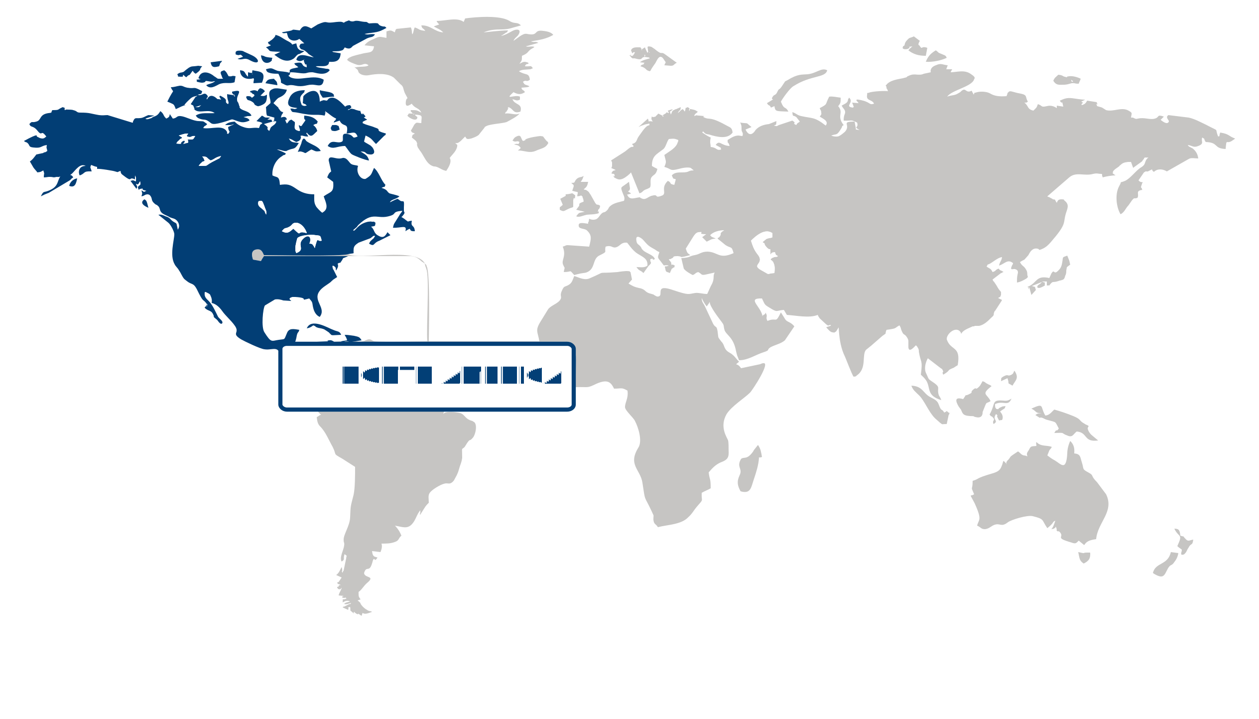
North America (Largest Region)
The urban UAV navigation and communication market was led by North America, which held a 39.96% share in 2026, supported by advanced unmanned aerial systems infrastructure, strong investment in autonomous technologies, and growing interest in the use of UAVs across urban environments. Demand for reliable navigation and communication systems is increasing as UAV applications expand across logistics, infrastructure inspection, emergency response, public safety, and other commercial activities. The region's established technology ecosystem and evolving regulatory frameworks for integrating drones into controlled airspace are also encouraging the development of more sophisticated positioning, connectivity, and traffic-management capabilities.
Europe (Fastest-Growing Region)
Europe is expected to emerge as the fastest-growing region, supported by increasing efforts to integrate UAVs safely into urban airspace and expand their use for commercial and public-sector applications. Growing adoption of drones for mobility, delivery, surveillance, infrastructure monitoring, and emergency services is creating demand for dependable navigation and communication technologies capable of operating in complex environments. Regulatory initiatives focused on safe and coordinated drone operations are encouraging the development of advanced traffic-management and communication infrastructure. At the same time, investments in autonomous mobility, smart-city infrastructure, and connected aerial systems are creating favorable conditions for the regional market's expansion.
| Parameter | North America | Asia Pacific | Europe | Latin America | MEA |
|---|---|---|---|---|---|
| Innovation Hub i Scale Nascent Developing Advanced | |||||
| Cost-Sensitive Region i Scale Low Medium High | |||||
| Regulatory Environment i Scale Restrictive Neutral Supportive | |||||
| Demand Drivers i Scale Weak Moderate Strong | |||||
| Development Stage i Scale Emerging Developing Developed | |||||
| Adoption Rate i Scale Low Medium High | |||||
| New Entrants / Startups i Scale Sparse Moderate Dense | |||||
| Macro Indicators i Scale Weak Stable Strong |
Key Country Insights
United States 🇺🇸
Advanced Urban Air SystemsThe U.S. is accelerating development of navigation and communication technologies that enable safe UAV operations in dense urban environments. Industry efforts focus on integrating unmanned aircraft with digital traffic management and advanced communication infrastructure.
Germany 🇩🇪
Precision Mobility InfrastructureGermany is emphasizing reliable UAV navigation technologies for urban logistics and industrial inspection applications. German developers are improving communication reliability and positioning accuracy to support safe operations alongside existing transport infrastructure.
Japan 🇯🇵
Smart City ConnectivityJapan is integrating UAV communication technologies into smart city initiatives that support inspection, emergency response, and urban services. Japanese organizations are prioritizing dependable navigation performance within densely populated metropolitan environments.
South Korea 🇰🇷
Connected Air MobilitySouth Korea is advancing communication networks that support UAV operations within digitally connected urban environments. National priorities include low-latency connectivity, autonomous navigation, and coordination with broader urban air mobility development programs.
France 🇫🇷
Urban Flight CoordinationFrance is strengthening UAV navigation capabilities for public safety, infrastructure monitoring, and commercial services in cities. French stakeholders are focusing on communication standards and airspace coordination to enable reliable urban drone operations.
Italy 🇮🇹
Municipal Drone IntegrationItaly is expanding urban UAV navigation capabilities to support infrastructure inspection, emergency services, and municipal operations. Italian technology providers are improving communication reliability and positioning solutions for increasingly complex city environments.
Segment Leadership and Growth Trends
Urban UAV Navigation and Communication Market Share (%), Level of Autonomy, 2026
Go beyond the chart, access full insights & data tables
Request Free Sample ReportComponent Segment Analysis: Hardware (Largest Segment) vs Services (Fastest-Growing Segment)
In the urban UAV navigation and communication market, the hardware segment held the largest share of 58.3% in 2026, supported by the essential role of onboard navigation systems, communication modules, sensors, antennas, processors, and positioning technologies in enabling reliable flight operations. Growing deployment of UAVs in complex urban environments has increased the need for high-performance hardware capable of ensuring precise navigation, secure connectivity, and operational resilience under demanding conditions. Continuous advancements in miniaturization, durability, and system integration have further strengthened the segment's leading position.
The services segment is expected to register the fastest growth as organizations increasingly require specialized support for deployment, system integration, maintenance, software updates, network optimization, and operational training. As urban UAV operations become more sophisticated and regulatory requirements evolve, demand for professional services that improve system reliability, ensure compliance, and maximize operational efficiency continues to expand. The growing adoption of managed and lifecycle support services is also contributing to the segment's accelerating momentum.
End-users Segment Analysis: Commercial (Largest & Fastest-Growing Segment)
Holding the largest share of the urban UAV navigation and communication market, the commercial segment accounted for 56.18% in 2026 and is also expected to remain the fastest-growing end-user category. Expanding adoption of UAVs for logistics, infrastructure inspection, mapping, surveying, media production, and urban monitoring has significantly increased demand for dependable navigation and communication technologies. Businesses are investing in advanced UAV capabilities to improve operational efficiency, reduce manual intervention, and enable real-time decision-making across diverse commercial applications. The continued expansion of smart city initiatives and growing acceptance of autonomous aerial operations are expected to reinforce the commercial segment's leadership.
Level of Autonomy Segment Analysis: Semi-autonomous UAVs (Largest Segment) vs Fully Autonomous UAVs (Fastest-Growing Segment)
Semi-autonomous UAVs represented the largest level of autonomy segment in 2026, reflecting their ability to combine automated navigation with human oversight for enhanced operational safety and regulatory compliance. These systems are widely preferred in urban missions where operators retain control during critical phases while benefiting from automated route planning, obstacle avoidance, and flight stabilization. Their balance of operational flexibility and reliability has supported widespread adoption across multiple application areas.
The urban UAV navigation and communication market is witnessing strong growth in fully autonomous UAVs as advances in artificial intelligence, machine learning, computer vision, and sensor fusion enable increasingly independent flight operations. Rising demand for scalable autonomous solutions capable of executing repetitive missions with minimal human intervention is encouraging broader deployment. Improvements in autonomous decision-making and navigation technologies are expected to further accelerate adoption as regulatory frameworks and urban air mobility ecosystems continue to mature.
| Segment | Sub-Segment | Largest Segment | Fastest Growing |
|---|---|---|---|
| Component | Hardware, Software, Services | Hardware | Services |
| End-users | Commercial, Government, Defense | Commercial | Commercial |
| Level of Autonomy | Fully Autonomous UAVs, Semi-autonomous UAVs | Semi-autonomous UAVs | Fully Autonomous UAVs |
| Range | Short-range UAVs (less Than 5 Km), Medium-range UAVs (5-25 Km), Long-range UAVs (over 25 Km) | Short-range UAVs (less Than 5 Km) | Long-range UAVs (over 25 Km) |
| Application | Urban Planning & Development, Surveillance & Security, Delivery Services, Infrastructure Inspection (bridges, Buildings, Power Lines), Others | Surveillance & Security | Delivery Services |
Competitive Landscape and Market Positioning
Leading companies in the urban UAV navigation and communication market:
- DJI (China)
- AeroVironment, Inc. (United States)
- Honeywell International, Inc. (United States)
- Trimble, Inc. (United States)
- Hexagon AB (Sweden)
- Skydio, Inc. (United States)
- Parrot Drones (France)
- Terra Drone Corporation (Japan)
- Collins Aerospace (United States)
- Elbit Systems Ltd. (Israel)
Urban airspace is becoming a proving ground where providers compete by combining resilient navigation, dependable communication, and intelligent traffic coordination into tightly integrated operating frameworks. As drone deployments expand into increasingly complex city environments, solution developers are prioritizing technologies that maintain positioning accuracy despite signal interference, dense infrastructure, and rapidly changing flight conditions. Competitive differentiation is also shifting toward platforms that support seamless interoperability with evolving airspace management systems, cybersecurity safeguards, and scalable software updates, reflecting customer demand for dependable performance across a wide range of commercial and public-sector missions.
| Company | Market Share | Company Revenue | Revenue CAGR (%) | Product Portfolio | Geographic Presence | Innovation / R&D Focus | Strategic Developments |
|---|---|---|---|---|---|---|---|
| DJI (China) | |||||||
| AeroVironment Inc. (United States) | |||||||
| Honeywell International Inc. (United States) | |||||||
| Trimble Inc. (United States) | |||||||
| Hexagon AB (Sweden) | |||||||
| Skydio Inc. (United States) | |||||||
| Parrot Drones (France) | |||||||
| Terra Drone Corporation (Japan) | |||||||
| Collins Aerospace (United States) | |||||||
| Elbit Systems Ltd. (Israel) |
Industry Development/News
| Company Name | Date | Key Development |
|---|
Explore This Report
Click a section of the wheel — or its numbered marker — to preview the custom segmentation, custom table of contents, or related reports available for this market.
Urban UAV Navigation and Communication Market — Custom Segments
| Segment | Sub-Segment |
|---|---|
| Communication Network Type | Cellular Networks, Dedicated RF Links, Wi-Fi & Short-Range Networks, Satellite Communication |
| Airspace Environment | Low-Altitude Urban Airspace, Dense Urban Airspace, Controlled Urban Airspace |
| UAV Size Class | Small UAVs, Medium UAVs, Large UAVs |
Urban UAV Navigation and Communication Market — report.custom
| Custom Chapter | Custom Details |
|---|---|
| Urban Airspace Integration Roadmap |
|
| Navigation & Communication Infrastructure Readiness |
|
| GNSS-Denied Urban Operations |
|
Need a different cut of the data?
Request Custom ResearchHow much is the urban UAV navigation and communication market worth?
What is the expected industry size of urban UAV navigation and communication by 2036?
How is rapid urban drone adoption shaping demand for navigation and communication technologies?
Why is AI becoming essential for urban UAV navigation systems?
Why does the hardware segment lead the urban UAV navigation and communication market?
Why are services the fastest-growing component segment in the urban UAV navigation and communication market?
Why does North America lead the urban UAV navigation and communication market?
What is driving the fastest growth of urban UAV navigation and communication in Europe?
What are the key competitors in the urban UAV navigation and communication landscape?
Our Clients
"The reports offered a comprehensive view of the Food and Beverage landscape, covering market trends, consumer behavior, and competitive dynamics."
"Our experience in acquiring market research reports has been outstanding — the depth of analysis and actionable insights have proven invaluable."
"Fundamental Business Insights demonstrated a keen understanding of our business needs, delivering reports tailored to our specific objectives."
Our Research Team & Methodology
Every Fundamental Business Insights report is built by a dedicated vertical research team, validated through a structured primary-and-secondary methodology, and reviewed for accuracy before it reaches you.
Research Team Overview
Prepared by the Aerospace & Defence Research Team
Delivery
Published
Demand
Available
Support
Trust & Compliance
Research Domains
10 coverage areasResearch Intelligence
| Source Category | Research Sources | Purpose |
|---|---|---|
| Government Publications | Government agencies, statistical departments, regulatory bodies | Industry statistics, regulatory insights, and policy analysis |
| Company Disclosures | Annual reports, investor presentations, financial filings | Company performance, business strategy, and market positioning |
| Trade Associations | Industry associations and professional organizations | Industry developments, standards, and market perspectives |
| Technical Literature | Research papers, technical publications, academic journals | Technology developments and technical validation |
| Patent Analysis | Patent databases and intellectual property publications | Innovation trends, technology activity, and competitive research |
| Industry Databases | Established research databases and market intelligence resources | Market benchmarking, historical data, and industry analysis |
Research Workflow & Quality Assurance
Data Collection
Verified information gathered through primary and secondary research.
Data Triangulation
Cross-validation using multiple independent data sources.
Forecast Modelling
Market estimates developed using historical trends and analytical models.
Analyst Validation
Findings reviewed by domain experts for accuracy and consistency.
Editorial & Quality Review
Final editorial, quality, and compliance checks before publication.
Final Publication
Released after successful completion of the internal review process.
Report Coverage
📊 Market Assessment
- Market Size & Forecast
- Market Segmentation
- Regional Analysis
- Growth Drivers & Challenges
- Market Dynamics
🏢 Competitive Intelligence
- Competitive Landscape
- Company Profiles
- Competitive Benchmarking
- Mergers & Acquisitions
- Market Share Analysis or Key Company Strategies
🔍 Strategic Analysis
- Value Chain Analysis
- Porter's Five Forces
- PESTLE Analysis
- Pricing Trends
- Supply-Demand Analysis
🚀 Future Outlook
- Technology Landscape
- Regulatory Landscape
- Investment & Funding Landscape
- Emerging Opportunities
- Future Market Outlook
Have a question about this report or need a custom scope?
Request Customization