Satellite Data Services Market Size & Growth Forecast 2026–2035, By Segments (Service, Deployment, End-use, Application), Regional Demand Trends (North America, Asia Pacific, Europe), Key Country Insights (U.S., Japan, South Korea, Germany, France, Italy), and Competitive Landscape
Market Size and Growoth Outlook
Satellite Data Services Market size was around USD 13.88 Billion in 2025 and is slated to grow at a 16% CAGR from 2026 to 2035, attaining USD 61.23 Billion by 2035. The industry revenue for 2026 is calculated at USD 15.85 billion.
Get more details on this report
Request Free Sample ReportSatellite Data Services Market Intelligence Snapshot
Regional Market Dynamics
- North America holds 38.16% share driven by mature space and geospatial ecosystem, strong defense and environmental use, and integration of satellite analytics into recurring commercial and government workflows.
- Asia Pacific grows at 17.92% CAGR with expanding use of satellite intelligence in agriculture, disaster response, urban planning, and resource monitoring supported by improving digital infrastructure and satellite programs.
Segment Momentum
- Image Data Service leads the market because it provides the foundational imagery used across earth observation, mapping, environmental monitoring, and security applications, supporting broad operational demand.
- Data Analytics Service is the fastest-growing segment as organizations increasingly prefer decision-ready insights that help interpret satellite data and support faster operational decision-making.
Market Expansion Drivers
- Increasing demand for high-resolution imagery supporting defense and environmental monitoring applications.
- Government investments in satellite infrastructure accelerating commercial space data service expansion.
- Growing integration of IoT and big data analytics enhancing satellite-enabled decision intelligence platforms.
Leading Market Participants
Global Market Forecast Snapshot
Market Outlook
Major players in the satellite data services market include Maxar Technologies Inc. (United States), Airbus SE (Netherlands), Planet Labs PBC (United States), ICEYE Oy (Finland), L3Harris Technologies, Inc. (United States), Ursa Space Systems Inc. (United States), NV5 Global, Inc. (United States), Satellite Imaging Corporation (United States), Geocento Ltd. (United Kingdom).Regional and Segment Outlook
North AmericaMarket Growth Drivers and Industry Trends
Rising requirements for precise, frequently updated earth observation data are shaping procurement patterns in the satellite data services market, particularly where defense agencies and environmental bodies need actionable intelligence rather than broad geospatial coverage. High-resolution imagery supports surveillance, border awareness, asset tracking, disaster assessment, land-use monitoring, and climate-related observation, which pushes buyers toward providers capable of delivering sharper imagery, shorter revisit cycles, and reliable analytics layers. This is driving demand for the satellite data services market by increasing the value of premium data subscriptions, tasking services, and image interpretation capabilities tied to mission-critical use cases where timeliness and spatial detail directly affect operational decisions.
Government investments in satellite infrastructure accelerating commercial space data service expansion
Public spending on launch systems, earth observation programs, ground stations, and national space capabilities is lowering structural barriers that would otherwise slow private participation in the satellite data services market. As governments fund upstream infrastructure and expand domestic space ecosystems, commercial providers gain improved access to satellite capacity, data pipelines, technical partnerships, and procurement opportunities that help scale service offerings more quickly. This supports market expansion by creating a more investable operating environment in which companies can commercialize downstream analytics, imagery distribution, and sector-specific data products without carrying the full burden of infrastructure development alone.
Growing integration of IoT and big data analytics enhancing satellite-enabled decision intelligence platforms
The convergence of connected sensors, cloud processing, and advanced analytics is changing how satellite-derived information is consumed, moving the satellite data services market beyond raw imagery and standalone datasets toward integrated decision systems. Satellite inputs are increasingly combined with IoT-generated field data, historical records, and predictive models to produce operational intelligence for logistics, agriculture, infrastructure monitoring, and remote asset management. That shift is influencing market adoption by rewarding providers that can embed satellite data into broader analytics platforms, where recurring demand is tied less to one-time data purchases and more to continuous monitoring, alerting, and decision-support workflows.
| Growth Driver | Impact on CAGR | Regulatory Influence | Geographic Relevance | Adoption Rate | Impact Timeline |
|---|---|---|---|---|---|
| Increasing demand for high-resolution imagery supporting defense and environmental monitoring applications | 2.00% | High | North America, Asia Pacific, Europe | High | Near Term |
| Government investments in satellite infrastructure accelerating commercial space data service expansion | 1.80% | High | North America, Asia Pacific | Medium | Mid Term |
| Growing integration of IoT and big data analytics enhancing satellite-enabled decision intelligence platforms | 1.50% | Moderate | Global | Emerging | Long Term |
Unlock insights tailored to your business with our bespoke market research solutions.
Click to get your customized report now.
Regional Demand Dynamics
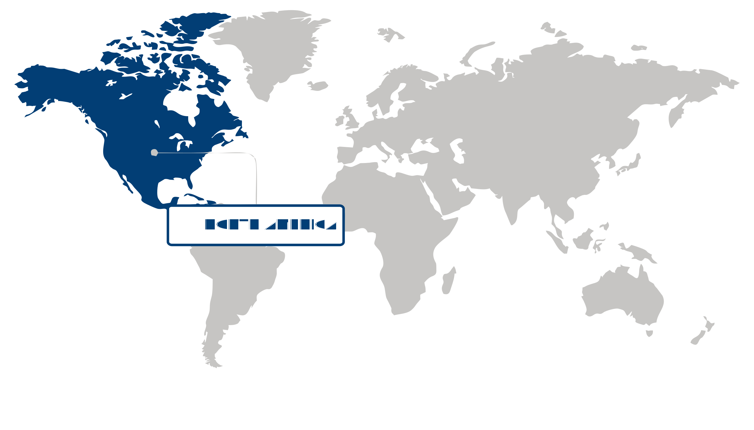
North America held a 38.16% share of the satellite data services market in 2025, supported by the region’s mature space and geospatial ecosystem, deep integration of satellite-derived data into defense, environmental monitoring, agriculture, and infrastructure workflows, and strong participation from commercial satellite operators and analytics providers. Leadership is underpinned by the way the market functions across the region: end users are not only purchasing raw imagery, but also contracting for higher-value analytics, persistent monitoring, and application-specific insights, which strengthens recurring demand and supports broader service adoption across public and private sectors.
Asia Pacific is set to expand at a 17.92% CAGR over the forecast period in the satellite data services market, propelled by rising use of satellite-based intelligence across agriculture management, disaster response, urban planning, and resource monitoring. Growth is accelerating because more regional economies are embedding space-based data into operational decision-making, while expanding satellite programs and digital infrastructure improve access to imagery, geospatial platforms, and downstream analytics. This is translating into stronger adoption by government agencies and commercial users that need scalable, timely data for large and diverse geographic areas.
| Parameter | North America | Asia Pacific | Europe | Latin America | MEA |
|---|---|---|---|---|---|
| Innovation Hub i Scale Nascent Developing Advanced | |||||
| Cost-Sensitive Region i Scale Low Medium High | |||||
| Regulatory Environment i Scale Restrictive Neutral Supportive | |||||
| Demand Drivers i Scale Weak Moderate Strong | |||||
| Development Stage i Scale Emerging Developing Developed | |||||
| Adoption Rate i Scale Low Medium High | |||||
| New Entrants / Startups i Scale Sparse Moderate Dense | |||||
| Macro Indicators i Scale Weak Stable Strong |
Key Country Insights
Germany 🇩🇪
Industrial Earth ObservationGermany applies satellite data services to industrial monitoring, environmental assessment, and infrastructure management. German organizations increasingly combine satellite imagery with geospatial analytics to improve operational decision-making across manufacturing, transportation, and public sector applications.
France 🇫🇷
Space Data CommercializationFrance emphasizes satellite data services that support environmental monitoring, agriculture, transportation, and public administration. French organizations increasingly convert geospatial information into value-added analytical services that improve operational planning and informed decision-making across multiple sectors.
Italy 🇮🇹
Infrastructure Monitoring FocusItaly utilizes satellite data services to support infrastructure inspection, agricultural management, and environmental observation programs. Organizations in Italy increasingly adopt geospatial intelligence to enhance asset monitoring, land management, and operational planning across public and private sectors.
Japan 🇯🇵
Disaster Monitoring ApplicationsJapan prioritizes satellite data services for disaster preparedness, infrastructure resilience, and environmental observation. Public agencies and commercial users in Japan increasingly leverage high-quality geospatial data to support risk assessment, resource planning, and emergency response activities.
South Korea 🇰🇷
Advanced Geospatial AnalyticsSouth Korea expands satellite data services through investments in digital infrastructure, smart cities, and environmental intelligence. Organizations in South Korea increasingly utilize satellite analytics to strengthen urban planning, security applications, and resource management initiatives.
United States 🇺🇸
Commercial Geospatial IntelligenceThe U.S. satellite data services market is driven by expanding demand for earth observation, defense applications, environmental monitoring, and commercial analytics. Organizations in the U.S. increasingly integrate satellite-derived insights into operational planning, infrastructure management, and business intelligence workflows.
Segment Leadership and Growth Trends
Satellite Data Services Market Share (%), Service, 2025
Go beyond the chart, access full insights & data tables
Request Free Sample ReportImage Data Service held the largest share of the satellite data services market in 2025, reflecting its central role as the foundational output used across earth observation, mapping, environmental monitoring, and security applications. Its leadership is maintained through steady demand for raw and processed imagery that supports direct operational use cases, where end users require timely visual data inputs before any deeper modeling or interpretation is applied. This broad applicability keeps Image Data Service at the core of purchasing activity in the satellite data services market and reinforces its leading share position.
Data Analytics Service is emerging as the fastest-growing part of the satellite data services market as customers increasingly look for actionable interpretation rather than large volumes of standalone data. Growth is being influenced by the practical need to convert satellite-derived information into usable insights for monitoring patterns, detecting change, and supporting faster decisions within operational workflows. Compared with image-only offerings, Data Analytics Service gains momentum because it reduces the technical burden on end users and aligns more closely with demand for decision-ready outputs.
Deployment Segment Analysis: Public (Largest & Fastest-Growing Segment)
Public accounted for the largest share of the satellite data services market in 2025 and is also the fastest-growing deployment segment, supported by broad accessibility and easier adoption across a wide user base. Its current leadership reflects the practicality of public deployment for organizations seeking scalable access to satellite data services without the added complexity of tightly controlled infrastructure models. Growth continues to build as users prioritize flexible consumption, quicker implementation, and wider data availability, allowing Public deployment to strengthen both its share and its expansion momentum within the satellite data services market.
| Segment | Sub-Segment | Largest Segment | Fastest Growing |
|---|---|---|---|
| Service | Image Data Service, Data Analytics Service | Image Data Service | Data Analytics Service |
| Deployment | Private, Public, Hybrid | Public | Public |
| End-use | Commercial, Government and Military, Service Providers | Government and Military | Service Providers |
| Application | Defense & Security, Energy & Utilities, Agriculture & Forestry, Environmental & Climate Monitoring, Engineering & Infrastructure Development, Marine, Others | Defense & Security | Environmental & Climate Monitoring |
Competitive Landscape and Market Positioning
1. Maxar Technologies Inc. (United States)
2. Airbus SE (Netherlands)
3. Planet Labs PBC (United States)
4. ICEYE Oy (Finland)
5. L3Harris Technologies Inc. (United States)
6. Ursa Space Systems Inc. (United States)
7. NV5 Global Inc. (United States)
8. Satellite Imaging Corporation (United States)
9. Geocento Ltd. (United Kingdom)
The satellite data services market is experiencing significant growth as industries increasingly rely on high-resolution geospatial intelligence for environmental monitoring, infrastructure planning, and defense operations. Enhanced analytics capabilities powered by AI and machine learning are improving the accuracy and usability of satellite-derived insights. Expanding demand for real-time data accessibility and advanced earth observation solutions is also driving innovation within the satellite data services market.
| Company | Market Share | Company Revenue | Revenue CAGR (%) | Product Portfolio | Geographic Presence | Innovation / R&D Focus | Strategic Developments |
|---|---|---|---|---|---|---|---|
| No companies available. | |||||||
Industry Development/News
| Company Name | Date | Key Development |
|---|---|---|
| TelePIX | Mar-26 | TelePIX secured ₩15 billion in pre-IPO funding from InterVest. The investment capital will scale the company's proprietary satellite AI architecture and expand its space-based data services portfolio as part of its strategic roadmap toward a planned listing on the KOSDAQ exchange. |
| FGC and Arabsat | Jul-25 | FGC and Arabsat established a strategic partnership to deliver managed satellite data and IP-based connectivity services across Saudi Arabia. The commercial initiative integrates Arabsat’s GEO KU-band infrastructure with FGC’s localized operational network to expand secure data service capabilities. |
| Ursa Space Systems | Jun-24 | Ursa Space Systems partnered with NEC Corporation to deliver advanced satellite image analysis services leveraging a massive virtual constellation of SAR and optical satellites. The joint operation initially targets Japanese commercial enterprises for disaster prevention and infrastructure tracking prior to planned global scaling. |
| ICEYE US | Sep-24 | ICEYE US secured a five-year blanket purchase agreement from NASA under the Commercial Smallsat Data Acquisition Program. The contract authorizes the company to supply high-resolution synthetic aperture radar data to support the scientific research, application goals, and environmental monitoring initiatives of NASA’s Earth Science Division. |
| Planet Labs | Sep-24 | Planet Labs signed a three-year data supply agreement with the German Space Agency at the German Aerospace Center. The partnership grants German scientific institutions structured access to the PlanetScope monitoring network and extensive historical imagery archives to facilitate advanced regional Earth observation research. |
| Hancom InSpace | May-26 | Hancom InSpace initiated the commercial monetization of its Sejong satellite imagery assets and confirmed an upcoming distribution integration with the SkyFi platform. This technical deployment expands the market availability of the company's automated, AI-powered satellite data analytics workflows. |
| Hanwha Group | Apr-26 | Hanwha Group accelerated its vertically integrated downstream space strategy by expanding its operational capacity in synthetic aperture radar satellite management. The expansion leverages newly integrated artificial intelligence capabilities to optimize high-throughput satellite data service delivery across manufacturing and ground operations. |
| Virgin Media O2 (VMO2) | Feb-26 | Virgin Media O2 expanded its mobile network data architecture through the commercial launch of O2 Satellite. Powered by Starlink Direct to Cell hardware, the infrastructure deployment enables Direct-to-Cell satellite data capabilities and continuous cellular connectivity for standard consumer smartphones. |
| Rogers Communications | Oct-25 | Rogers Communications scaled its satellite-to-mobile infrastructure in Canada by expanding its existing Starlink-powered Direct-to-Cell technical framework. The operational upgrade transitions the service architecture beyond basic satellite messaging and voice telemetry to support high-bandwidth, app-based mobile satellite data capabilities. |
| KDDI | Aug-25 | KDDI finalized a network integration to become the inaugural Japanese mobile carrier providing direct-to-smartphone satellite data services utilizing Starlink's satellite constellation. The deployment establishes reliable wide-area satellite data connectivity for standard mobile handsets outside the coverage zones of traditional terrestrial cell sites. |
Explore This Report
Click a section of the wheel — or its numbered marker — to preview the custom segmentation, custom table of contents, or related reports available for this market.
Satellite Data Services Market — Custom Segments
| Segment | Sub-Segment |
|---|---|
| No segment data available. | |
Satellite Data Services Market — report.custom
| Custom Chapter | Custom Details | ||
|---|---|---|---|
| No custom TOC data available. | |||
Need a different cut of the data?
Request Custom ResearchHow large is the satellite data services market?
What is the expected industry size of satellite data services by 2035?
How is demand for high-resolution imagery influencing the satellite data services market?
Why is the integration of IoT and big data analytics accelerating adoption of satellite data services?
Why is Image Data Service the largest segment in the satellite data services market?
Which service segment is growing the fastest in the satellite data services market?
What supports North America’s leadership in the satellite data services market?
How is Asia Pacific driving growth in satellite data services market?
Who holds a significant market share in the satellite data services landscape?
Our Clients
"The reports offered a comprehensive view of the Food and Beverage landscape, covering market trends, consumer behavior, and competitive dynamics."
"Our experience in acquiring market research reports has been outstanding — the depth of analysis and actionable insights have proven invaluable."
"Fundamental Business Insights demonstrated a keen understanding of our business needs, delivering reports tailored to our specific objectives."
Our Research Team & Methodology
Every Fundamental Business Insights report is built by a dedicated vertical research team, validated through a structured primary-and-secondary methodology, and reviewed for accuracy before it reaches you.
Research Team Overview
Prepared by the Aerospace & Defence Research Team
Delivery
Published
Demand
Available
Support
Trust & Compliance
Research Domains
10 coverage areasResearch Intelligence
| Source Category | Research Sources | Purpose |
|---|---|---|
| Government Publications | Government agencies, statistical departments, regulatory bodies | Industry statistics, regulatory insights, and policy analysis |
| Company Disclosures | Annual reports, investor presentations, financial filings | Company performance, business strategy, and market positioning |
| Trade Associations | Industry associations and professional organizations | Industry developments, standards, and market perspectives |
| Technical Literature | Research papers, technical publications, academic journals | Technology developments and technical validation |
| Patent Analysis | Patent databases and intellectual property publications | Innovation trends, technology activity, and competitive research |
| Industry Databases | Established research databases and market intelligence resources | Market benchmarking, historical data, and industry analysis |
Research Workflow & Quality Assurance
Data Collection
Verified information gathered through primary and secondary research.
Data Triangulation
Cross-validation using multiple independent data sources.
Forecast Modelling
Market estimates developed using historical trends and analytical models.
Analyst Validation
Findings reviewed by domain experts for accuracy and consistency.
Editorial & Quality Review
Final editorial, quality, and compliance checks before publication.
Final Publication
Released after successful completion of the internal review process.
Report Coverage
📊 Market Assessment
- Market Size & Forecast
- Market Segmentation
- Regional Analysis
- Growth Drivers & Challenges
- Market Dynamics
🏢 Competitive Intelligence
- Competitive Landscape
- Company Profiles
- Competitive Benchmarking
- Mergers & Acquisitions
- Market Share Analysis or Key Company Strategies
🔍 Strategic Analysis
- Value Chain Analysis
- Porter's Five Forces
- PESTLE Analysis
- Pricing Trends
- Supply-Demand Analysis
🚀 Future Outlook
- Technology Landscape
- Regulatory Landscape
- Investment & Funding Landscape
- Emerging Opportunities
- Future Market Outlook
Have a question about this report or need a custom scope?
Request Customization