Geospatial Solutions Market Size & Growth Forecast 2026–2035, By Segments (End Use, Component, Technology, Application), Regional Demand Trends (North America, Asia Pacific, Europe), Key Country Insights (U.S., Japan, South Korea, Germany, France, Italy), and Competitive Landscape
Market Size and Growoth Outlook
Geospatial Solutions Market size was over USD 486.03 Billion in 2025 and is likely to grow at a 14.4% CAGR between 2026 and 2035, attaining USD 1.87 Trillion by 2035. The industry revenue for 2026 is assessed at USD 548.61 billion.
Get more details on this report
Request Free Sample ReportGeospatial Solutions Market Intelligence Snapshot
Regional Market Dynamics
- North America held a 35.30% market share in 2025, supported by mature GIS and satellite capabilities, broad enterprise adoption, and recurring demand for location intelligence across infrastructure and public-sector operations.
- Asia Pacific is projected to grow at a 16.13% CAGR, fueled by rapid urban development, infrastructure programs, and increasing deployment of spatial technologies for smart cities, land administration, and disaster management.
Segment Momentum
- Utility held a 19.8% market share in 2025 because organizations depend on geospatial solutions for asset maintenance, network planning, outage response, and regulatory compliance across widely distributed infrastructure.
- Services are expanding rapidly as organizations require implementation, integration, customization, and ongoing support to deploy geospatial systems effectively across complex operational environments and legacy infrastructure.
Market Expansion Drivers
- AI and cloud-enabled geospatial analytics improving real-time spatial data processing accuracy.
- Smart city initiatives driving geospatial adoption for urban planning and infrastructure optimization.
- Defense modernization and UAV integration expanding geospatial intelligence and surveillance capabilities.
Leading Market Participants
Global Market Forecast Snapshot
Market Outlook
Prominent companies in the geospatial solutions market include Hexagon AB (Sweden), Trimble Inc. (United States), Microsoft Corporation (United States), Google LLC (United States), Bentley Systems, Incorporated (United States), Oracle Corporation (United States), SAP SE (Germany), TomTom N.V. (Netherlands), L3Harris Technologies, Inc. (United States), Esri, Inc. (United States).Regional and Segment Outlook
North AmericaMarket Growth Drivers and Industry Trends
Rising use of AI models deployed through cloud-based platforms is reshaping how organizations handle high-volume satellite imagery, sensor feeds, and location data, increasing demand for the geospatial solutions market where speed and precision increasingly determine operational value. Cloud infrastructure reduces the need for on-premise processing while allowing agencies, utilities, logistics operators, and environmental teams to analyze continuously updated spatial datasets at scale. AI improves feature extraction, anomaly detection, and pattern recognition, which makes geospatial outputs more usable in time-sensitive workflows such as route optimization, asset monitoring, land-use assessment, and disaster response. This combination is influencing market adoption by shifting purchasing decisions toward integrated platforms that can automate interpretation and deliver accurate spatial intelligence fast enough for live decision environments.
Smart city initiatives driving geospatial adoption for urban planning and infrastructure optimization
As city authorities invest in connected infrastructure, digital twins, traffic management, utility mapping, and land administration, the geospatial solutions market is benefiting from the need to unify fragmented urban data into location-based planning systems. Municipal decision-makers rely on geospatial platforms to visualize population density, transport flows, zoning constraints, and public service coverage in a form that supports practical infrastructure choices rather than static reporting. That use case is supporting market expansion because urban modernization programs often require recurring updates, cross-department data interoperability, and spatial modeling tools that can guide road design, drainage planning, energy distribution, and emergency response coordination. The result is stronger integration of geospatial software and services into long-cycle city development and infrastructure optimization budgets.
Defense modernization and UAV integration expanding geospatial intelligence and surveillance capabilities
Defense agencies are increasing deployment of UAVs, advanced sensors, and networked command systems, creating a steady requirement for geospatial platforms that can process, interpret, and distribute terrain, movement, and targeting data with high reliability. In the geospatial solutions market, this is reinforcing market demand for tools that support mission planning, border monitoring, battlefield awareness, and reconnaissance by converting aerial and remote sensing inputs into actionable geospatial intelligence. UAV integration changes procurement behavior in practice because defense users need systems that can ingest continuous imagery streams, fuse them with existing mapping layers, and deliver usable outputs quickly to operational teams. That operational requirement is driving market development around secure analytics, real-time visualization, and intelligence-grade spatial data management.
| Growth Driver | Impact on CAGR | Regulatory Influence | Geographic Relevance | Adoption Rate | Impact Timeline |
|---|---|---|---|---|---|
| AI and cloud-enabled geospatial analytics improving real-time spatial data processing accuracy | 2.30% | Moderate | North America, Asia Pacific | High | Near Term |
| Smart city initiatives driving geospatial adoption for urban planning and infrastructure optimization | 2.00% | High | Global | High | Mid Term |
| Defense modernization and UAV integration expanding geospatial intelligence and surveillance capabilities | 1.70% | High | North America, Europe | High | Mid Term |
Unlock insights tailored to your business with our bespoke market research solutions.
Click to get your customized report now.
Regional Demand Dynamics
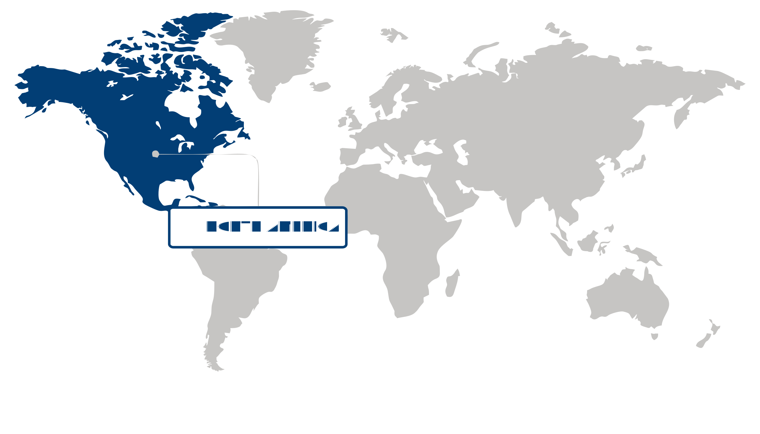
North America held a 35.30% share of the geospatial solutions market in 2025, supported by broad enterprise and public-sector use of location intelligence across infrastructure management, defense, transportation, utilities, and environmental monitoring. The region’s leadership is aided by mature digital mapping ecosystems, established satellite and GIS capabilities, and steady spending on data-driven planning and asset tracking. In practice, this creates a strong base of recurring demand for geospatial platforms, analytics, and integration services as organizations rely on spatial data to manage operations, improve situational awareness, and support regulatory and planning requirements.
Asia Pacific is projected to expand at a 16.13% CAGR over the forecast period, with growth in the geospatial solutions market being fueled by rapid urban development, large-scale infrastructure programs, and widening adoption of spatial technologies in land administration, smart city initiatives, and disaster management. Demand is accelerating as governments and enterprises digitize physical assets and use location-based data to guide construction, mobility planning, and resource monitoring. The region’s growth pattern reflects rising implementation activity, where new deployments are being built into modernization programs rather than added as incremental upgrades.
| Parameter | North America | Asia Pacific | Europe | Latin America | MEA |
|---|---|---|---|---|---|
| Innovation Hub i Scale Nascent Developing Advanced | |||||
| Cost-Sensitive Region i Scale Low Medium High | |||||
| Regulatory Environment i Scale Restrictive Neutral Supportive | |||||
| Demand Drivers i Scale Weak Moderate Strong | |||||
| Development Stage i Scale Emerging Developing Developed | |||||
| Adoption Rate i Scale Low Medium High | |||||
| New Entrants / Startups i Scale Sparse Moderate Dense | |||||
| Macro Indicators i Scale Weak Stable Strong |
Key Country Insights
Germany 🇩🇪
Infrastructure Mapping ExcellenceGermany is strengthening geospatial solutions for transportation, utilities, and urban infrastructure projects. Organizations prioritize accurate spatial data integration to improve planning efficiency, regulatory compliance, and long-term infrastructure management.
France 🇫🇷
Environmental Data IntegrationFrance applies geospatial solutions to environmental monitoring, land management, and public infrastructure planning. Organizations increasingly integrate satellite imagery and geographic information systems to support sustainable resource management and informed planning decisions.
Italy 🇮🇹
Heritage Infrastructure MappingItaly employs geospatial solutions for infrastructure modernization alongside cultural heritage preservation and land management. Spatial technologies are increasingly adopted to improve maintenance planning, environmental monitoring, and regional development initiatives.
Japan 🇯🇵
Disaster Mapping CapabilitiesJapan utilizes geospatial solutions extensively for disaster preparedness, infrastructure monitoring, and urban planning. Public agencies and commercial users increasingly rely on high-resolution spatial data to support timely risk assessment and operational decision-making.
South Korea 🇰🇷
Smart City AnalyticsSouth Korea incorporates geospatial solutions into smart city initiatives, transportation management, and digital public services. Demand continues growing for platforms that combine real-time location data with advanced analytics to improve operational efficiency.
United States 🇺🇸
Enterprise Spatial IntelligenceThe U.S. continues expanding geospatial solutions across infrastructure, logistics, defense, and environmental management. Organizations are integrating location intelligence with cloud analytics and artificial intelligence to strengthen operational planning and asset management capabilities.
Segment Leadership and Growth Trends
Geospatial Solutions Market Share (%), End Use, 2025
Go beyond the chart, access full insights & data tables
Request Free Sample ReportUtility held a 19.8% share of the geospatial solutions market in 2025, making it the leading end-use segment. Its position is sustained by the operational need to map, monitor, and manage widely distributed power, water, and gas infrastructure with high location accuracy. Utilities rely on geospatial solutions to support asset maintenance, network planning, outage response, and regulatory compliance, which keeps demand steady and deeply embedded in day-to-day field operations. This recurring operational dependence helps the Utility segment retain its market leadership.
Defense & Intelligence is emerging as the fastest-growing end-use segment in the geospatial solutions market as security environments increasingly depend on real-time spatial awareness and integrated intelligence workflows. Growth is being driven by the practical requirement to process location-based data for surveillance, mission planning, threat detection, and border monitoring with greater speed and precision than conventional systems allow. Compared with more established civilian uses, Defense & Intelligence is gaining momentum because geospatial capabilities are becoming more central to decision-making in dynamic and data-intensive operational settings.
Component Segment Analysis: Software (Largest Segment) vs Services (Fastest-Growing Segment)
By 2025, Software accounted for the largest share of the geospatial solutions market among components. This leadership reflects the central role of software platforms in capturing, processing, visualizing, and analyzing spatial data across end-use environments. Organizations depend on geospatial software as the core operating layer that turns raw location data into usable outputs for planning, monitoring, and field execution, which keeps software spending foundational rather than optional. That embedded functional role is the main reason the Software segment continues to lead.
Services represent the fastest-growing component in the geospatial solutions market as users increasingly need implementation, integration, customization, and ongoing support to translate geospatial tools into working operational systems. Growth is being supported by the practical complexity of deploying geospatial solutions across diverse data sources, legacy infrastructure, and specialized use cases. Relative to software alone, services are gaining traction because buyers often need external expertise to accelerate adoption, improve system performance, and ensure that geospatial capabilities align with real-world workflows.
| Segment | Sub-Segment | Largest Segment | Fastest Growing |
|---|---|---|---|
| End Use | Utility, Business, Transportation, Defense & Intelligence, Infrastructure Development, Natural Resources, Others | Utility | Defense & Intelligence |
| Component | Hardware, Software, Services | Software | Services |
| Technology | GIS/Geospatial Analytics, Remote Sensing, GPS, 3D Scanning | GIS/Geospatial Analytics | 3D Scanning |
| Application | Surveying & Mapping, Geovisualization, Planning & Analysis, Land Management, Others | Surveying & Mapping | Land Management |
Competitive Landscape and Market Positioning
1. Hexagon AB (Sweden)
2. Trimble Inc. (United States)
3. Microsoft Corporation (United States)
4. Google LLC (United States)
5. Bentley Systems Incorporated (United States)
6. Oracle Corporation (United States)
7. SAP SE (Germany)
8. TomTom N.V. (Netherlands)
9. L3Harris Technologies Inc. (United States)
10. Esri Inc. (United States)
The geospatial solutions market is expanding due to increasing reliance on location-based intelligence across industries. Advanced analytics and mapping technologies are improving spatial accuracy and decision support. Ecosystem integration is enhancing cross-industry applicability and data utilization.
| Company | Market Share | Company Revenue | Revenue CAGR (%) | Product Portfolio | Geographic Presence | Innovation / R&D Focus | Strategic Developments |
|---|---|---|---|---|---|---|---|
| No companies available. | |||||||
Industry Development/News
| Company Name | Date | Key Development |
|---|---|---|
| VertiGIS | Apr-25 | VertiGIS acquired 1Spatial to consolidate its geospatial software portfolio and enhance its global market presence. The integration of 1Spatial’s data management and network technologies strengthens VertiGIS’s capacity to deliver next-generation intelligent geospatial solutions and expands its competitive footprint in the geospatial software sector. |
| Neo Space Group | Apr-25 | Neo Space Group acquired UP42 from Airbus Defence and Space, a strategic move that significantly bolsters its geospatial data platform capabilities. This acquisition enhances the company's position within the global Earth observation and geospatial intelligence market by integrating advanced data distribution and processing infrastructure. |
| Collecte Localisation Satellites (CLS) | Apr-25 | CLS acquired Australian firm NGIS to strengthen its Earth observation and geospatial service offerings. The acquisition facilitates geographic expansion into the Asia-Pacific region and enhances CLS’s technical capabilities in delivering sophisticated geospatial intelligence solutions to government and commercial clients. |
| Descartes Labs | Mar-25 | Descartes Labs acquired Geosite to broaden its geospatial analytics capabilities. This transaction is designed to create new commercial opportunities within the insurance and risk assessment sectors, enabling more granular geospatial analysis and data-driven insights for high-stakes risk management applications. |
| Genesys International | Mar-25 | Genesys International was awarded a ₹155 crore contract by the Brihanmumbai Municipal Corporation to develop a digital twin and 3D city mapping platform. This project underscores the company's capability in executing large-scale geospatial infrastructure initiatives and reinforces its market position in urban modeling and smart city development. |
| Sumitomo Corporation of Americas | Apr-25 | Sumitomo Corporation of Americas made a strategic investment in Ursa Space Systems to accelerate the expansion of geospatial intelligence and Earth observation services. The funding is targeted at scaling operations and service delivery within Asian markets, with a specific focus on capturing demand in Japan. |
| Suhora Technologies | Apr-25 | Suhora Technologies secured a multi-year, seven-figure partnership with Satellogic to obtain exclusive rights for high-resolution Earth observation services in India and Nepal. By leveraging its SPADE platform, the company is expanding regional access to specialized geospatial intelligence solutions and enhancing its competitive service delivery model. |
| Woolpert | Apr-25 | Woolpert acquired Bluesky International, a provider of aerial survey and geospatial data services in the United Kingdom. This acquisition expands Woolpert's global geospatial portfolio and enhances its proprietary data acquisition capabilities, supporting a broader service reach across international markets. |
| Esri | Jul-24 | Esri integrated its spatial analytics technology with Microsoft Fabric to provide seamless access to advanced geospatial tools within a unified SaaS environment. This technological collaboration enables enterprise-level data scientists and analysts to leverage sophisticated spatial modeling directly within Microsoft's analytics ecosystem, streamlining workflows for complex geospatial projects. |
| e-GEOS | Apr-25 | e-GEOS entered a multi-year strategic partnership with Synspective to integrate Earth observation services with Synthetic Aperture Radar (SAR) satellite capabilities. This collaboration aims to enhance the delivery of advanced geospatial intelligence and monitoring solutions, providing global customers with more robust and versatile observational data for complex operational environments. |
Explore This Report
Click a section of the wheel — or its numbered marker — to preview the custom segmentation, custom table of contents, or related reports available for this market.
Geospatial Solutions Market — Custom Segments
| Segment | Sub-Segment |
|---|---|
| No segment data available. | |
Geospatial Solutions Market — report.custom
| Custom Chapter | Custom Details | ||
|---|---|---|---|
| No custom TOC data available. | |||
Need a different cut of the data?
Request Custom ResearchWhat is the market valuation of geospatial solutions?
What are the growth projections for the geospatial solutions industry?
How is AI and cloud adoption reshaping purchasing priorities in the geospatial solutions market?
How are smart city and defense modernization programs influencing geospatial deployment strategies?
Why is the Utility segment leading the geospatial solutions market?
Why are services the fastest-growing component in the geospatial solutions market?
Why does North America lead the geospatial solutions market?
What is driving geospatial solutions market growth in Asia Pacific?
Which companies dominate the geospatial solutions landscape?
Our Clients
"The reports offered a comprehensive view of the Food and Beverage landscape, covering market trends, consumer behavior, and competitive dynamics."
"Our experience in acquiring market research reports has been outstanding — the depth of analysis and actionable insights have proven invaluable."
"Fundamental Business Insights demonstrated a keen understanding of our business needs, delivering reports tailored to our specific objectives."
Our Research Team & Methodology
Every Fundamental Business Insights report is built by a dedicated vertical research team, validated through a structured primary-and-secondary methodology, and reviewed for accuracy before it reaches you.
Research Team Overview
Prepared by the Smart Technologies Research Team
Delivery
Published
Demand
Available
Support
Trust & Compliance
Research Domains
10 coverage areasResearch Intelligence
| Source Category | Research Sources | Purpose |
|---|---|---|
| Government Publications | Government agencies, statistical departments, regulatory bodies | Industry statistics, regulatory insights, and policy analysis |
| Company Disclosures | Annual reports, investor presentations, financial filings | Company performance, business strategy, and market positioning |
| Trade Associations | Industry associations and professional organizations | Industry developments, standards, and market perspectives |
| Technical Literature | Research papers, technical publications, academic journals | Technology developments and technical validation |
| Patent Analysis | Patent databases and intellectual property publications | Innovation trends, technology activity, and competitive research |
| Industry Databases | Established research databases and market intelligence resources | Market benchmarking, historical data, and industry analysis |
Research Workflow & Quality Assurance
Data Collection
Verified information gathered through primary and secondary research.
Data Triangulation
Cross-validation using multiple independent data sources.
Forecast Modelling
Market estimates developed using historical trends and analytical models.
Analyst Validation
Findings reviewed by domain experts for accuracy and consistency.
Editorial & Quality Review
Final editorial, quality, and compliance checks before publication.
Final Publication
Released after successful completion of the internal review process.
Report Coverage
📊 Market Assessment
- Market Size & Forecast
- Market Segmentation
- Regional Analysis
- Growth Drivers & Challenges
- Market Dynamics
🏢 Competitive Intelligence
- Competitive Landscape
- Company Profiles
- Competitive Benchmarking
- Mergers & Acquisitions
- Market Share Analysis or Key Company Strategies
🔍 Strategic Analysis
- Value Chain Analysis
- Porter's Five Forces
- PESTLE Analysis
- Pricing Trends
- Supply-Demand Analysis
🚀 Future Outlook
- Technology Landscape
- Regulatory Landscape
- Investment & Funding Landscape
- Emerging Opportunities
- Future Market Outlook
Have a question about this report or need a custom scope?
Request Customization