Mobile Mapping Market Size & Growth Forecast 2026–2035, By Segments (Component, Technology Type, Mounting Type, Industry Vertical, Application), Regional Demand Trends (North America, Asia Pacific, Europe), Key Country Insights (U.S., Japan, South Korea, Germany, France, Italy), and Competitive Landscape
Market Size and Growoth Outlook
Mobile Mapping Market size was more than USD 41.17 Billion in 2025 and is set to grow at a 16.3% CAGR between 2026 and 2035, surpassing USD 186.37 Billion by 2035. The industry revenue for 2026 is estimated at USD 47.13 billion.
Get more details on this report
Request Free Sample ReportMobile Mapping Market Intelligence Snapshot
Regional Market Dynamics
- North America held a 29.16% market share in 2025, supported by strong adoption across transportation, utilities, urban planning, and infrastructure monitoring requiring high-accuracy geospatial data.
- Asia Pacific is projected to grow at an 18.26% CAGR, driven by infrastructure expansion, smart city initiatives, and rising demand for efficient large-scale geospatial data collection.
Segment Momentum
- Hardware accounted for 55.65% of the market in 2025 because sensors, cameras, scanners, and positioning systems are essential for field data capture, while upgrades and replacement cycles sustain demand.
- LiDAR is the fastest-growing technology as organizations increasingly require highly detailed 3D mapping and precise spatial data for roads, infrastructure, terrain, and environmental modeling applications.
Market Expansion Drivers
- Rapid adoption of LiDAR and GNSS-enabled mapping systems enhancing real-time spatial data capture.
- Expansion of smart city and infrastructure projects driving high-precision geospatial analytics demand.
- Integration of drones and IoT sensors improving large-scale automated mapping and surveying workflows.
Leading Market Participants
Global Market Forecast Snapshot
Market Outlook
Leading companies in the mobile mapping market include Alphabet Inc. (United States), Trimble Inc. (United States), Hexagon AB (Sweden), TOPCON CORPORATION (Japan), Teledyne Technologies Incorporated (United States), RIEGL Laser Measurement Systems GmbH (Austria), GreenValley International Inc. (United States), Hi-Target Surveying Instrument Co., Ltd. (China), imajing SAS (France), FARO Technologies, Inc. (United States).Regional and Segment Outlook
North AmericaMarket Growth Drivers and Industry Trends
The rapid adoption of LiDAR and GNSS-enabled platforms is strengthening development of the mobile mapping market by making high-accuracy spatial data collection faster, more consistent, and less dependent on labor-intensive fieldwork. In practice, operators can capture road corridors, utility assets, construction zones, and urban environments in motion while preserving positional accuracy, which changes procurement decisions in favor of integrated mobile systems rather than fragmented surveying methods. This trend is driving demand for the mobile mapping market from engineering firms, transport agencies, and asset owners that need current geospatial datasets for design validation, maintenance planning, and digital twin updates without extended site closures or repeated manual surveys.
Expansion of smart city and infrastructure projects driving high-precision geospatial analytics demand
Expansion of smart city and infrastructure programs is increasing market adoption for the mobile mapping market because these projects depend on precise, frequently updated geospatial intelligence to plan, monitor, and manage complex physical assets. Transit upgrades, roadway modernization, utility expansion, and public space digitization all require dense location data that can feed asset inventories, 3D city models, and condition assessment systems, pushing buyers toward mobile mapping platforms that can collect standardized data at scale. The result is reinforcing market demand as public agencies and infrastructure contractors place greater emphasis on interoperable spatial datasets that support project execution and long-term operational visibility.
Integration of drones and IoT sensors improving large-scale automated mapping and surveying workflows
Integration of drones and IoT sensors is aiding market expansion by extending how the mobile mapping market fits into automated surveying workflows rather than functioning as a standalone capture tool. Drone-based imaging and sensor feeds from connected infrastructure allow mapping providers to combine ground-level, aerial, and real-time field data into a more continuous spatial record, reducing gaps in coverage and improving update cycles for large or hard-to-access sites. That practical improvement is influencing market adoption among construction, utilities, mining, and municipal operators that want faster data refresh, lower field revisits, and tighter linkage between spatial capture and downstream analytics systems.
| Growth Driver | Impact on CAGR | Regulatory Influence | Geographic Relevance | Adoption Rate | Impact Timeline |
|---|---|---|---|---|---|
| Rapid adoption of LiDAR and GNSS-enabled mapping systems enhancing real-time spatial data capture | 2.30% | Moderate | North America, Asia Pacific | High | Near Term |
| Expansion of smart city and infrastructure projects driving high-precision geospatial analytics demand | 2.00% | High | Asia Pacific, Europe | High | Near Term |
| Integration of drones and IoT sensors improving large-scale automated mapping and surveying workflows | 1.80% | Moderate | North America, Asia Pacific | Medium | Mid Term |
Unlock insights tailored to your business with our bespoke market research solutions.
Click to get your customized report now.
Regional Demand Dynamics
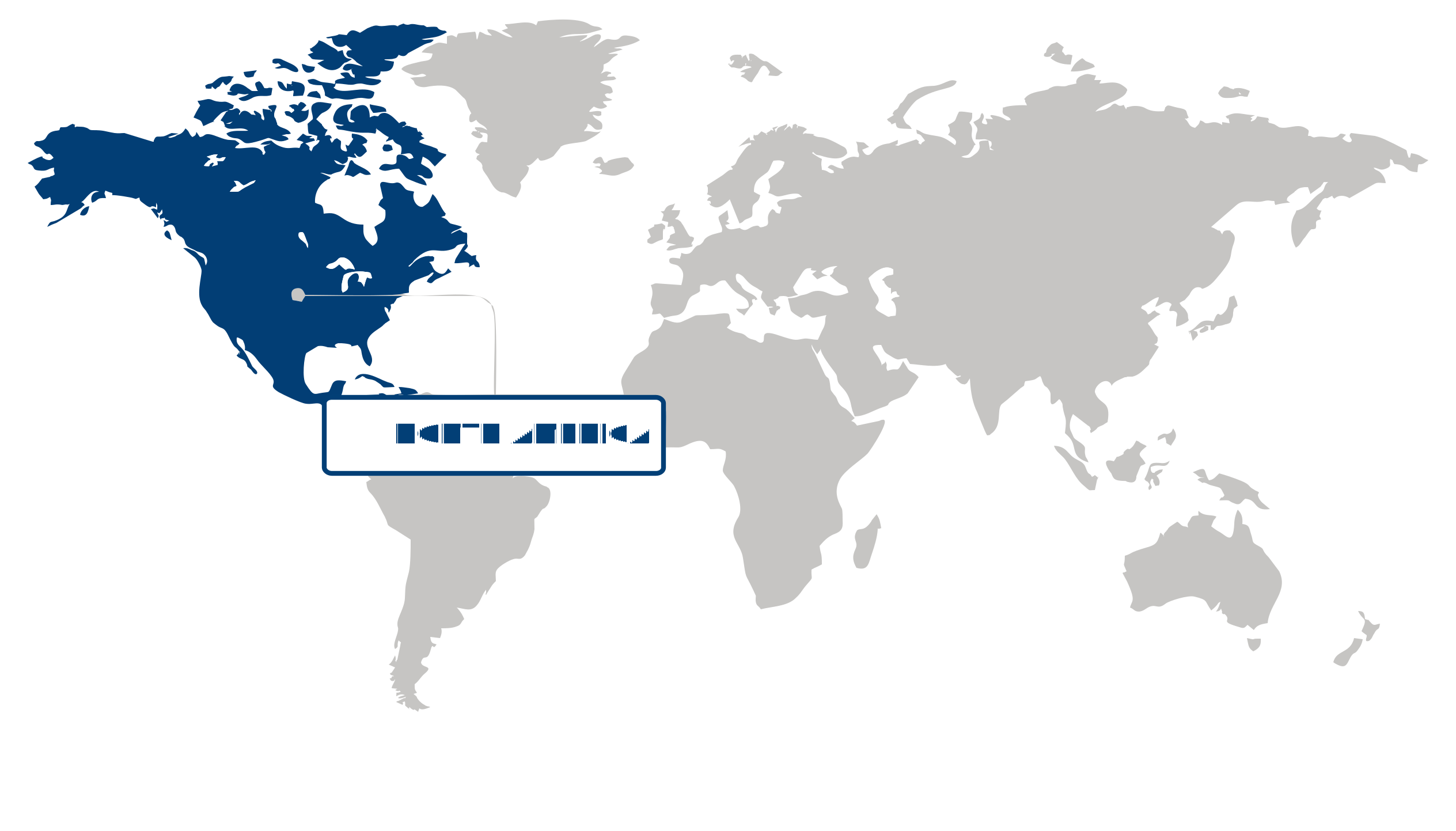
North America held a 29.16% share of the mobile mapping market in 2025, supported by widespread deployment of geospatial technologies across transportation, utilities, urban planning, and public sector operations. The region’s leadership is reinforced by established digital infrastructure, strong adoption of location intelligence in field operations, and consistent use of mapping-based data capture for asset inspection, road network management, and autonomous mobility development. In practice, this creates a steady flow of demand for high-accuracy mobile mapping systems as organizations prioritize real-time spatial data for operational planning and infrastructure monitoring.
Asia Pacific is projected to expand at an 18.26% CAGR over the forecast period, with growth propelled by rapid infrastructure development, accelerating smart city programs, and broader integration of geospatial data into construction, transport, and municipal planning workflows. Demand for the mobile mapping market is rising as governments and enterprises across the region scale road surveying, land administration, and urban digitalization projects that require efficient, large-area data collection. Adoption is also being strengthened by the need to map fast-changing built environments more frequently, which favors mobile platforms that can capture detailed spatial information with greater speed and operational flexibility.
| Parameter | North America | Asia Pacific | Europe | Latin America | MEA |
|---|---|---|---|---|---|
| Innovation Hub i Scale Nascent Developing Advanced | |||||
| Cost-Sensitive Region i Scale Low Medium High | |||||
| Regulatory Environment i Scale Restrictive Neutral Supportive | |||||
| Demand Drivers i Scale Weak Moderate Strong | |||||
| Development Stage i Scale Emerging Developing Developed | |||||
| Adoption Rate i Scale Low Medium High | |||||
| New Entrants / Startups i Scale Sparse Moderate Dense | |||||
| Macro Indicators i Scale Weak Stable Strong |
Key Country Insights
Germany 🇩🇪
Industrial Survey PrecisionGermany prioritizes mobile mapping solutions that support transportation infrastructure, engineering, and industrial digitalization projects. Demand centers on highly accurate geospatial data collection that integrates with BIM and digital twin initiatives.
France 🇫🇷
Public Infrastructure AnalyticsFrance emphasizes mobile mapping solutions for transportation networks, municipal asset management, and environmental monitoring. Public agencies and engineering firms increasingly rely on detailed geospatial datasets to support infrastructure modernization programs.
Italy 🇮🇹
Heritage Asset DocumentationItaly utilizes mobile mapping technologies to support transportation projects alongside cultural heritage preservation and urban redevelopment. Organizations prioritize accurate digital surveying solutions that streamline infrastructure planning and long-term asset management.
Japan 🇯🇵
Urban Mapping EfficiencyJapan adopts mobile mapping technologies to improve urban planning, smart transportation, and disaster resilience initiatives. Organizations focus on compact, high-precision systems capable of efficiently capturing data across densely developed environments.
South Korea 🇰🇷
Smart Infrastructure MappingSouth Korea expands mobile mapping deployment for smart city development, connected mobility, and telecommunications infrastructure. Businesses increasingly integrate real-time geospatial data with intelligent analytics to improve infrastructure planning and maintenance.
United States 🇺🇸
Geospatial Innovation HubThe U.S. advances the mobile mapping market through autonomous mobility, infrastructure monitoring, and utility asset management applications. Organizations increasingly deploy AI-enabled mapping platforms that combine LiDAR, imaging, and cloud analytics for faster decision-making.
Segment Leadership and Growth Trends
Mobile Mapping Market Share (%), Component, 2025
Go beyond the chart, access full insights & data tables
Request Free Sample ReportHardware held the dominant position in the mobile mapping market in 2025, accounting for a 55.65% share. This dominance is rooted in the essential role of physical systems such as sensors, cameras, scanners, and positioning units that form the operational base of mobile mapping deployments. Buyers cannot execute field-based data capture without these core devices, which keeps hardware spending central to project budgets. The segment’s leadership is also sustained by ongoing replacement cycles, system upgrades, and the need for reliable, high-precision equipment in demanding mapping environments.
Software is emerging as the fastest-growing segment in the mobile mapping market as users place greater emphasis on processing, integrating, and extracting usable insights from large volumes of spatial data. Growth is being encouraged by the practical need to turn raw field captures into structured outputs for analysis, visualization, and decision-making. Compared with hardware, software is gaining momentum because value creation increasingly depends on how efficiently collected data can be managed and converted into actionable mapping intelligence, making advanced processing platforms more central to new deployments and workflow expansion.
Technology Type Segment Analysis: GNSS (Largest Segment) vs LiDAR (Fastest-Growing Segment)
In 2025, GNSS represented the largest technology segment in the mobile mapping market with a 50.88% share. Its continued leadership comes from its foundational role in location referencing and route positioning across mobile mapping operations. GNSS remains deeply embedded in standard mapping workflows because accurate geospatial alignment is necessary for nearly every mobile capture application. Its broad compatibility with existing systems and its function as a baseline positioning technology help sustain its leading share across routine and large-scale deployments.
LiDAR is the fastest-growing technology segment in the mobile mapping market because demand is increasing for richer three-dimensional spatial capture and higher-detail environmental modeling. The technology is gaining traction as users seek more precise representation of roads, buildings, terrain, and infrastructure than conventional alternatives can provide. Relative to other technologies, LiDAR is advancing quickly because it strengthens the quality and depth of captured data in use cases where detailed structural information directly improves mapping outcomes.
| Segment | Sub-Segment | Largest Segment | Fastest Growing |
|---|---|---|---|
| Component | Hardware, Software, Services | Hardware | Software |
| Technology Type | GNSS, RADAR, LiDAR | GNSS | LiDAR |
| Mounting Type | Vehicle-Mounted, Railway-Mounted, Drone-Mounted, Others | Drone-Mounted | Vehicle-Mounted |
| Industry Vertical | Agriculture, Oil & Gas, Government & Public Sector, Telecommunication, Energy & Utilities, Others | Agriculture | Government & Public Sector |
| Application | Asset Management, Automotive Navigation, Infrastructure Maintenance, Topographic Mapping, 3D Modeling, Road Surveys, Others | Automotive Navigation | 3D Modeling |
Competitive Landscape and Market Positioning
1. Alphabet Inc. (United States)
2. Trimble Inc. (United States)
3. Hexagon AB (Sweden)
4. TOPCON CORPORATION (Japan)
5. Teledyne Technologies Incorporated (United States)
6. RIEGL Laser Measurement Systems GmbH (Austria)
7. GreenValley International Inc. (United States)
8. Hi-Target Surveying Instrument Co. Ltd. (China)
9. imajing SAS (France)
10. FARO Technologies Inc. (United States)
The mobile mapping market is expanding rapidly with advanced geospatial data capture technologies. Integration of AI and real-time analytics is improving mapping accuracy and usability. Increased adoption across infrastructure and urban planning is driving innovation. The mobile mapping market is becoming essential for precision-driven spatial intelligence solutions.
| Company | Market Share | Company Revenue | Revenue CAGR (%) | Product Portfolio | Geographic Presence | Innovation / R&D Focus | Strategic Developments |
|---|---|---|---|---|---|---|---|
| No companies available. | |||||||
Industry Development/News
| Company Name | Date | Key Development |
|---|---|---|
| Woolpert | Jul-25 | Woolpert acquired UK-based Bluesky International to expand its global geospatial services portfolio. The acquisition significantly enhances Woolpert’s aerial mapping and high-resolution data capture capabilities, strengthening its competitive position in providing integrated geospatial solutions for large-scale infrastructure, environmental monitoring, and government-sector mapping projects. |
| Leica Geosystems | Jul-25 | Leica Geosystems introduced the Pegasus TRK300 mobile mapping system, utilizing dual-head multi-beam laser scanning. The system is designed to increase field efficiency and data accuracy, supporting high-precision requirements in infrastructure surveying, asset management, and urban transportation mapping by optimizing the data acquisition workflow for large-scale professional projects. |
| Trimble | Jul-25 | Trimble launched the Applanix POSPac Complete post-processing software to optimize mobile mapping and geospatial data workflows. The software provides advanced positioning data refinement, increasing accuracy and efficiency for professional surveying and mobile data acquisition systems, which directly improves the viability of high-precision outputs for complex infrastructure projects. |
| Kudan Inc. | Jul-25 | Kudan Inc. expanded its partnership with UCS Co., Ltd. to integrate its core SLAM and mapping technologies into robotics and broadcast workflows. This strategic pivot broadens the company's addressable market beyond traditional mapping into automation and digital media production, enhancing its commercial footprint in the broader spatial intelligence and digital environment sector. |
| TOPCON CORPORATION | Jun-23 | Topcon Corporation acquired Finland-based SATEL, a developer of wireless connectivity solutions. By integrating SATEL’s mission-critical communication technologies, Topcon strengthens its high-accuracy positioning systems, enhancing the resilience and reliability of data transmission essential for professional-grade mobile mapping and geospatial hardware. |
| Teledyne Geospatial | Apr-23 | Teledyne Geospatial launched three automated services on its CARIS Cloud platform, focused on the processing, management, and distribution of hydrospatial data. These services streamline the production of digital charts and bathymetry products, improving operational efficiency for stakeholders involved in maritime surveying and underwater data management. |
| GreenValley International | Nov-22 | GreenValley International formed a strategic partnership with GDU Technology to provide integrated solutions for the architecture, engineering, and construction (AEC) sectors. By combining GreenValley’s high-precision 3D mapping hardware with GDU’s unmanned systems expertise, the collaboration offers an end-to-end aerial surveying solution tailored for industrial infrastructure projects. |
Explore This Report
Click a section of the wheel — or its numbered marker — to preview the custom segmentation, custom table of contents, or related reports available for this market.
Mobile Mapping Market — Custom Segments
| Segment | Sub-Segment |
|---|---|
| No segment data available. | |
Mobile Mapping Market — report.custom
| Custom Chapter | Custom Details | ||
|---|---|---|---|
| No custom TOC data available. | |||
Need a different cut of the data?
Request Custom ResearchWhat is the market valuation of mobile mapping?
How is the mobile mapping industry size expected to evolve during the forecast period?
How is the adoption of integrated LiDAR and GNSS systems changing procurement strategies in the mobile mapping market?
How are smart city programs and drone/IoT integration shaping mobile mapping workflows and demand?
Why does the Hardware segment dominate the mobile mapping market?
Which technology is expanding the fastest in the mobile mapping market?
Why is North America the largest mobile mapping market?
Why is Asia Pacific the fastest-growing region for the mobile mapping market?
Which companies dominate the mobile mapping landscape?
Our Clients
"The reports offered a comprehensive view of the Food and Beverage landscape, covering market trends, consumer behavior, and competitive dynamics."
"Our experience in acquiring market research reports has been outstanding — the depth of analysis and actionable insights have proven invaluable."
"Fundamental Business Insights demonstrated a keen understanding of our business needs, delivering reports tailored to our specific objectives."
Our Research Team & Methodology
Every Fundamental Business Insights report is built by a dedicated vertical research team, validated through a structured primary-and-secondary methodology, and reviewed for accuracy before it reaches you.
Research Team Overview
Prepared by the Smart Technologies Research Team
Delivery
Published
Demand
Available
Support
Trust & Compliance
Research Domains
10 coverage areasResearch Intelligence
| Source Category | Research Sources | Purpose |
|---|---|---|
| Government Publications | Government agencies, statistical departments, regulatory bodies | Industry statistics, regulatory insights, and policy analysis |
| Company Disclosures | Annual reports, investor presentations, financial filings | Company performance, business strategy, and market positioning |
| Trade Associations | Industry associations and professional organizations | Industry developments, standards, and market perspectives |
| Technical Literature | Research papers, technical publications, academic journals | Technology developments and technical validation |
| Patent Analysis | Patent databases and intellectual property publications | Innovation trends, technology activity, and competitive research |
| Industry Databases | Established research databases and market intelligence resources | Market benchmarking, historical data, and industry analysis |
Research Workflow & Quality Assurance
Data Collection
Verified information gathered through primary and secondary research.
Data Triangulation
Cross-validation using multiple independent data sources.
Forecast Modelling
Market estimates developed using historical trends and analytical models.
Analyst Validation
Findings reviewed by domain experts for accuracy and consistency.
Editorial & Quality Review
Final editorial, quality, and compliance checks before publication.
Final Publication
Released after successful completion of the internal review process.
Report Coverage
📊 Market Assessment
- Market Size & Forecast
- Market Segmentation
- Regional Analysis
- Growth Drivers & Challenges
- Market Dynamics
🏢 Competitive Intelligence
- Competitive Landscape
- Company Profiles
- Competitive Benchmarking
- Mergers & Acquisitions
- Market Share Analysis or Key Company Strategies
🔍 Strategic Analysis
- Value Chain Analysis
- Porter's Five Forces
- PESTLE Analysis
- Pricing Trends
- Supply-Demand Analysis
🚀 Future Outlook
- Technology Landscape
- Regulatory Landscape
- Investment & Funding Landscape
- Emerging Opportunities
- Future Market Outlook
Have a question about this report or need a custom scope?
Request Customization