Remote Sensing Satellite Market Size & Forecasts 2026-2035, By Segments (End-use, Orbit, Application, Satellite Mass), Growth Opportunities, Innovation Landscape, Regulatory Shifts, Strategic Regional Insights (U.S., Japan, China, South Korea, UK, Germany, France), and Competitive Dynamics (Airbus, Thales Alenia Space, Boeing, Maxar Technologies, Lockheed Martin)
Market Size and Growoth Outlook
Remote Sensing Satellite Market size is predicted to expand from USD 44.95 billion in 2025 to USD 160.88 billion by 2035, with growth underpinned by a CAGR above 13.6% between 2026 and 2035. The industry revenue outlook for 2026 is USD 50.42 billion.
Get more details on this report
Request Free Sample ReportRemote Sensing Satellite Market Intelligence Snapshot
Regional Market Dynamics
Segment Momentum
Market Expansion Drivers
Leading Market Participants
Global Market Forecast Snapshot
Market Outlook
Regional and Segment Outlook
Market Growth Drivers and Industry Trends
Increased Adoption of Satellites for Climate Monitoring & Disaster Management
The growing urgency of climate change and natural disasters has propelled the increased adoption of satellites for climate monitoring and disaster management within the remote sensing satellite market. Organizations like NASA and the European Space Agency have emphasized the critical role of satellite data in tracking environmental changes and responding to disasters. This trend reflects a heightened consumer awareness of climate issues and a demand for actionable insights that can be derived from satellite imagery. Strategic opportunities arise for established players like Maxar Technologies, which offers advanced Earth observation solutions, and for new entrants focusing on niche applications in climate resilience. As governments and NGOs ramp up their funding for climate initiatives, the remote sensing satellite market is poised to play a vital role in shaping sustainable development strategies.
Rising Investments in Commercial Satellite Constellations
The surge in investments in commercial satellite constellations is reshaping the competitive landscape of the remote sensing satellite market. Companies like SpaceX and OneWeb are spearheading efforts to deploy large fleets of low Earth orbit satellites, significantly enhancing global connectivity and data accessibility. This influx of capital not only accelerates technological advancements but also democratizes access to high-resolution imagery, catering to diverse sectors, including agriculture, urban planning, and telecommunications. Established players can leverage partnerships with tech firms to enhance their service offerings, while new entrants can explore innovative business models that capitalize on the growing demand for real-time data. The increasing reliance on satellite data for decision-making processes in various industries underscores the strategic importance of this driver in the evolving market.
Integration of AI & Big Data Analytics in Satellite Remote Sensing
The integration of artificial intelligence (AI) and big data analytics into satellite remote sensing is revolutionizing the capabilities of the remote sensing satellite market. By enabling the processing of vast amounts of satellite data, AI enhances the accuracy and speed of insights derived from Earth observation. Companies like Planet Labs are already utilizing machine learning algorithms to analyze land-use changes and monitor agricultural health, demonstrating the transformative potential of these technologies. This integration not only creates significant opportunities for established firms to refine their offerings but also opens avenues for startups focused on AI-driven analytics solutions. As industries increasingly seek to harness data for strategic decision-making, the focus on AI and big data will likely remain a cornerstone of innovation in the remote sensing satellite market.
Industry Restraints:
Technological Obsolescence Risks
The rapid pace of technological advancement presents a significant constraint for the remote sensing satellite market. Companies face increasing pressure to innovate and upgrade their satellite systems to remain competitive, as older technologies become obsolete. This is particularly evident in the context of Earth observation capabilities, where advancements in sensor technology and data processing are critical. For instance, the European Space Agency (ESA) has emphasized the need for next-generation satellites that can deliver higher resolution imagery and more accurate data analytics to meet evolving market demands. Established players, while having the resources to invest in R&D, may struggle with the integration of new technologies into legacy systems, leading to operational inefficiencies. New entrants, on the other hand, may find it challenging to secure funding for innovative projects amidst a landscape dominated by established firms, thereby stifling overall market growth.
Launch Cost Volatility
The volatility of launch costs poses a substantial challenge for the remote sensing satellite market, impacting both operational budgets and strategic planning. Fluctuations in launch prices, driven by factors such as geopolitical tensions, supply chain disruptions, and the capacity of launch providers, can lead to unpredictable project timelines and financial forecasts. For example, SpaceX's recent price adjustments have raised concerns among smaller satellite operators who rely on cost-effective launch solutions to enter the market. The National Oceanic and Atmospheric Administration (NOAA) has reported that inconsistent launch costs can deter investment in new satellite projects, particularly for government agencies and research institutions that operate on fixed budgets. As market participants navigate these financial uncertainties, they must adopt more flexible business models and diversify their launch partnerships to mitigate risks. In the near to medium term, this restraint is likely to continue shaping investment strategies, as companies seek to balance innovation with cost management in an increasingly competitive landscape.
| Growth Driver | Impact on CAGR | Regulatory Influence | Geographic Relevance | Adoption Rate | Impact Timeline |
|---|---|---|---|---|---|
| Increased adoption of satellites for climate monitoring & disaster management | 2.50% | Short term (≤ 2 yrs) | Asia Pacific, North America (spillover: Europe) | Medium | Fast |
| Rising investments in commercial satellite constellations | 2.00% | Medium term (2–5 yrs) | North America, Europe (spillover: Asia Pacific) | Low | Fast |
| Integration of AI & big data analytics in satellite remote sensing | 1.80% | Long term (5+ yrs) | Europe, Asia Pacific (spillover: North America) | Medium | Moderate |
Unlock insights tailored to your business with our bespoke market research solutions.
Click to get your customized report now.
Regional Demand Dynamics
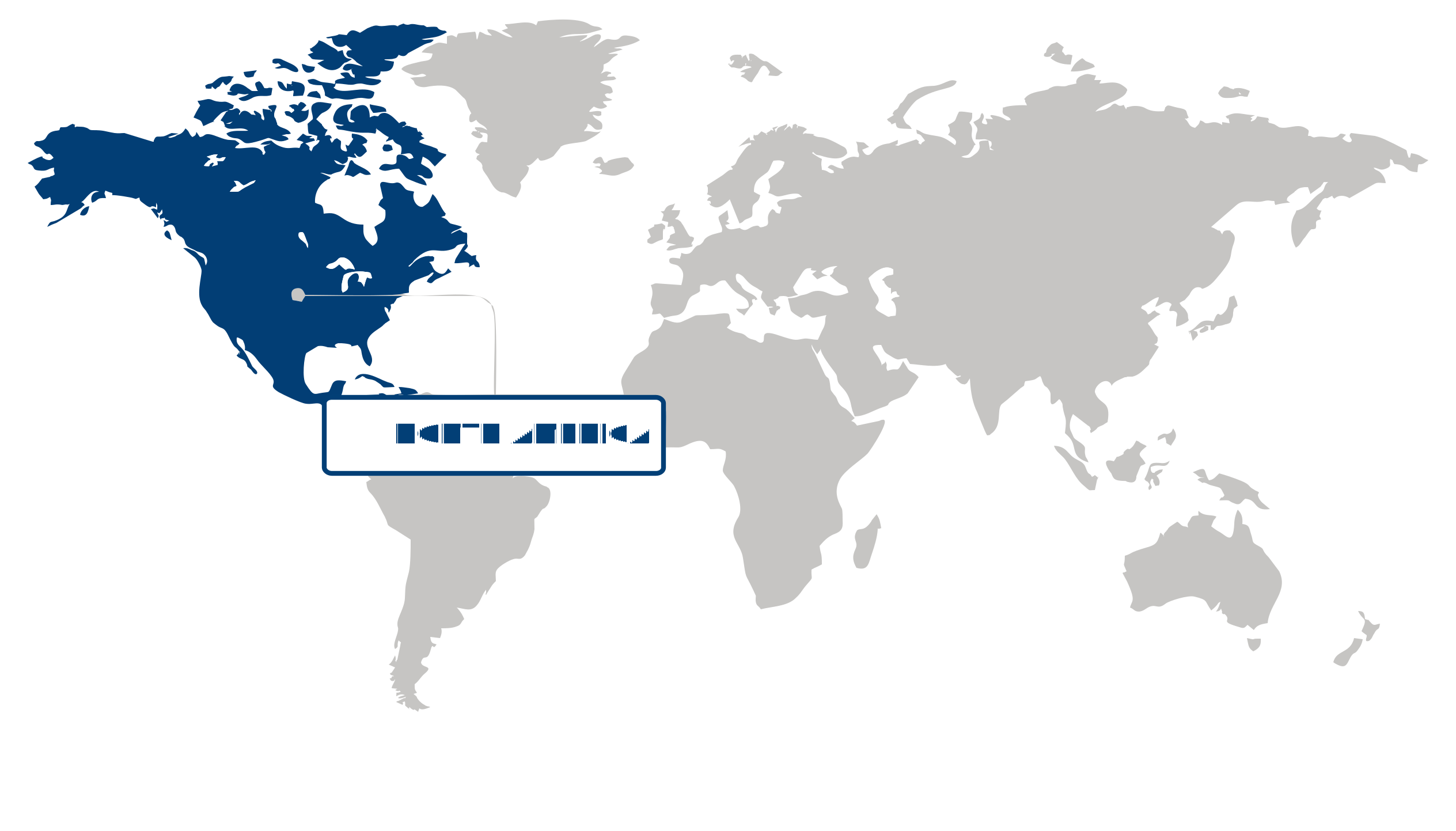
North America Market Statistics:
North America captured over 43.26% of the global remote sensing satellite market in 2025, establishing itself as the largest and fastest-growing region in this sector. This dominance is primarily driven by advanced space technology and defense initiatives, which have catalyzed significant investments and innovations in satellite capabilities. The region's leadership can be attributed to a robust demand for high-resolution imagery and data analytics, spurred by increasing applications in agriculture, environmental monitoring, and national security. Moreover, the emphasis on sustainability and regulatory frameworks promoting space activities have further fueled growth, as evidenced by the National Aeronautics and Space Administration (NASA) and the Federal Aviation Administration (FAA) enhancing their support for commercial satellite ventures. As a result, North America presents substantial opportunities for stakeholders in the remote sensing satellite market, driven by technological advancements and a resilient economic landscape.
The United States anchors the North American market for remote sensing satellites, leveraging its extensive investments in advanced space technology and defense. The U.S. government, through agencies like the National Oceanic and Atmospheric Administration (NOAA), has prioritized the development of satellite systems that enhance weather forecasting and disaster response capabilities. This focus on innovative satellite applications aligns with a growing consumer demand for real-time data and analytics in various sectors, including agriculture and urban planning. Furthermore, the competitive landscape is characterized by significant activity from private companies, such as SpaceX and Planet Labs, which are reshaping the market dynamics with their innovative satellite solutions. This strategic positioning underscores the U.S.'s vital role in the regional remote sensing satellite market, highlighting its potential for further expansion and collaboration in advanced satellite technologies.
Canada complements the North American remote sensing satellite market by emphasizing its unique capabilities in Earth observation and environmental monitoring. The Canadian Space Agency (CSA) has been instrumental in fostering partnerships between government and industry, facilitating the development of satellites that address climate change and natural resource management. The country’s commitment to sustainability and environmental stewardship resonates with increasing consumer preferences for responsible data utilization in sectors like forestry and agriculture. Notably, the successful launch of the RADARSAT Constellation Mission showcases Canada’s technological prowess in providing vital data for various applications. As Canada continues to innovate and collaborate, it reinforces the North American market's leadership in remote sensing satellites, presenting opportunities for cross-border partnerships and advancements in satellite technology.
Asia Pacific Market Analysis:
The Asia Pacific region has emerged as the fastest-growing area in the remote sensing satellite market, registering rapid growth with a robust CAGR of 16%. This dynamic expansion is primarily driven by the increasing demand for earth observation and telecommunications, which are pivotal in enhancing various sectors, including agriculture, urban planning, and disaster management. The region's significant investments in satellite technology and infrastructure are indicative of a broader trend toward digital transformation, reflecting a shift in consumer preferences towards data-driven decision-making and sustainable practices. Notably, initiatives by organizations such as the Asia-Pacific Space Cooperation Organization (APSCO) highlight the collaborative efforts among member states to leverage satellite technology for regional development, thus amplifying the market's growth potential.
Japan plays a crucial role in the Asia Pacific remote sensing satellite market by leveraging its advanced technological capabilities and strong governmental support for space initiatives. The country's emphasis on innovation is evident in its recent projects, such as the launch of the Advanced Land Observing Satellite-2 (ALOS-2) by the Japan Aerospace Exploration Agency (JAXA), which enhances earth observation capabilities for urban and agricultural applications. Additionally, Japan's regulatory environment fosters collaboration between public and private sectors, driving competitive strategies that prioritize sustainability and efficiency in satellite deployment. These factors collectively contribute to Japan's strategic positioning in the regional market, reinforcing its contribution to the growing demand for earth observation technologies.
China, as another key player in the remote sensing satellite market, exhibits a unique approach driven by its expansive national programs and ambitious space exploration goals. The Chinese government has significantly increased funding for satellite development, leading to advancements in capabilities that cater to both domestic and international markets. The recent launch of the Tianwen-1 Mars mission underscores China's commitment to enhancing its satellite technology portfolio, which not only supports earth observation needs but also boosts its telecommunications infrastructure. Consumer demand in China is shifting towards high-resolution imagery and real-time data analytics, aligning with the global trend towards digitalization. This evolving landscape positions China as a vital contributor to the Asia Pacific region's market growth, creating substantial opportunities for collaboration and investment in the remote sensing satellite sector.
Europe Market Trends:
The Europe region has maintained a notable presence in the remote sensing satellite market, characterized by lucrative growth driven by a combination of technological advancements and heightened demand for environmental monitoring. This region's significance stems from its robust regulatory frameworks and sustainability priorities, which encourage investments in satellite technologies to address climate change and resource management. For instance, the European Space Agency (ESA) has actively promoted initiatives like the Copernicus program, which enhances Earth observation capabilities across member states, reflecting a commitment to leveraging satellite data for societal benefits. As European nations increasingly recognize the strategic value of remote sensing in various sectors, including agriculture, urban planning, and disaster management, the market is poised for continued expansion, presenting substantial opportunities for investors and stakeholders.
Germany plays a pivotal role in the remote sensing satellite market, showcasing strong growth fueled by its advanced technological landscape and commitment to innovation. The country is home to several leading aerospace companies, such as Airbus Defence and Space, which are at the forefront of developing high-resolution satellite systems for applications ranging from climate monitoring to defense. Recent collaborations between the German government and private sector entities, as reported by the Federal Ministry for Economic Affairs and Energy, emphasize the importance of satellite data in enhancing national security and environmental sustainability. This synergy between government policy and industry innovation positions Germany as a key player in the European market, offering strategic advantages for future investments.
France also holds a significant position in the remote sensing satellite market, driven by its strong emphasis on research and development in aerospace technologies. The French space agency CNES has been instrumental in advancing satellite capabilities, particularly through its involvement in international projects like the Sentinel missions under the Copernicus program. The French market is characterized by a competitive landscape, with companies such as Thales Alenia Space leading the charge in developing cutting-edge remote sensing solutions. As consumer demand for accurate and timely environmental data continues to rise, France's commitment to enhancing its satellite infrastructure not only supports national objectives but also contributes to the overall growth of the European market, making it an attractive destination for investment and collaboration.
| Parameter | North America | Asia Pacific | Europe | Latin America | MEA |
|---|---|---|---|---|---|
| Innovation Hub i Scale Nascent Developing Advanced | |||||
| Cost-Sensitive Region i Scale Low Medium High | |||||
| Regulatory Environment i Scale Restrictive Neutral Supportive | |||||
| Demand Drivers i Scale Weak Moderate Strong | |||||
| Development Stage i Scale Emerging Developing Developed | |||||
| Adoption Rate i Scale Low Medium High | |||||
| New Entrants / Startups i Scale Sparse Moderate Dense | |||||
| Macro Indicators i Scale Weak Stable Strong |
Segment Leadership and Growth Trends
Remote Sensing Satellite Market Share (%), End-use, 2025
Go beyond the chart, access full insights & data tables
Request Free Sample ReportAnalysis by End-use
The remote sensing satellite market is primarily driven by the commercial segment, which captured over 56.65% share in 2025. This dominance is attributed to the rising demand for high-resolution imagery, particularly in agriculture and urban planning, as stakeholders increasingly rely on accurate data for decision-making. Companies like Planet Labs and DigitalGlobe have emphasized the importance of high-quality imagery for optimizing agricultural yields and enhancing urban infrastructure. This segment not only caters to established firms but also opens avenues for startups focusing on innovative imaging technologies. Given the ongoing advancements in satellite technology and increasing public-private partnerships, the commercial segment is expected to maintain its significance in the near to medium term.
Analysis by Orbit
The remote sensing satellite market is significantly influenced by the low earth orbit (LEO) segment, which held a commanding 58.2% share in 2025. This leadership stems from LEO's cost-effective deployment capabilities, allowing for frequent imaging and data collection, essential for applications spanning environmental monitoring to telecommunications. Notably, companies like SpaceX and OneWeb are pioneering LEO satellite constellations that enhance global connectivity and data accessibility. The increasing emphasis on real-time data and sustainability in satellite operations further fortifies this segment's position, presenting strategic advantages for both established aerospace firms and new entrants. As the demand for timely and accurate data grows, LEO satellites are poised to remain a cornerstone of the remote sensing landscape.
Analysis by Application
The remote sensing satellite market is prominently shaped by the weather forecasting application, which represented more than 41.2% of the market in 2025. This segment is crucial due to the critical need for real-time climate data for effective disaster management and resource allocation. Organizations such as the National Oceanic and Atmospheric Administration (NOAA) are increasingly leveraging satellite data to improve forecasting accuracy and response strategies. The growing awareness of climate change impacts and the need for sustainable practices amplify the relevance of this application. This segment not only supports established meteorological agencies but also provides opportunities for tech firms developing advanced predictive analytics tools. With the ongoing evolution of climate monitoring technologies, the weather forecasting application is expected to remain vital in the coming years.
| Segment | Sub-Segment | Largest Segment | Fastest Growing |
|---|---|---|---|
| End-use | Government, Commercial | ||
| Orbit | Low earth orbit (LEO), Medium earth orbit (MEO), Geostationary earth orbit (GEO) | ||
| Application | Weather forecasting, Agriculture and forestry farming, Infrastructure and urban planning, Others | ||
| Satellite Mass | Less than 100 kg, 100 -500 KG, 500 -1000 Kg, Above 1000 Kg |
Competitive Landscape and Market Positioning
Key players in the remote sensing satellite market include industry giants such as Airbus, Thales Alenia Space, Boeing, and Maxar Technologies, each holding a significant position due to their advanced technological capabilities and established market presence. Lockheed Martin and Planet Labs further enhance the competitive landscape with their innovative approaches and comprehensive service offerings. Additionally, Spire Global, GeoOptics, ICEYE, and Capella Space contribute to the diversity of the market, focusing on niche applications and specialized data solutions. These companies collectively shape the market dynamics through their commitment to innovation and operational excellence, establishing themselves as leaders in remote sensing technology.
The competitive environment in the remote sensing satellite market is characterized by a flurry of strategic initiatives aimed at enhancing capabilities and expanding market share. Major players are actively engaging in collaborations that foster technological advancements and broaden their service portfolios. Noteworthy advancements in satellite technology and data analytics are being driven by investments in research and development, enabling companies to deliver cutting-edge solutions. Furthermore, the pursuit of partnerships and alliances is evident as firms seek to synergize their strengths, positioning themselves to respond effectively to evolving customer demands and competitive pressures. This dynamic interplay of initiatives not only enhances their competitive edge but also propels innovation within the sector.
Strategic / Actionable Recommendations for Regional Players
In North America, fostering partnerships with technology startups can enhance the development of next-generation satellite systems and data analytics platforms, ensuring that established firms remain at the forefront of innovation. Engaging in collaborative projects that leverage artificial intelligence and machine learning can significantly enhance data processing capabilities, providing a competitive advantage in delivering actionable insights to clients.
In the Asia Pacific region, focusing on high-growth sub-segments such as agricultural monitoring and disaster management can unlock new revenue streams. Forming alliances with local governments and research institutions can facilitate access to unique datasets and enhance the applicability of remote sensing technologies in addressing regional challenges.
For Europe, prioritizing sustainability in satellite operations can resonate with regulatory frameworks and public sentiment. Emphasizing eco-friendly practices and developing satellites with reduced carbon footprints can appeal to environmentally conscious stakeholders. Additionally, exploring collaborations with European Space Agency initiatives can provide access to funding and technical expertise, bolstering competitive positioning in the market.
| Company | Market Share | Company Revenue | Revenue CAGR (%) | Product Portfolio | Geographic Presence | Innovation / R&D Focus | Strategic Developments |
|---|---|---|---|---|---|---|---|
| No companies available. | |||||||
Industry Development/News
| Company Name | Date | Key Development |
|---|---|---|
| GalaxEye | May-26 | GalaxEye successfully deployed its Drishti satellite, the world’s first OptoSAR satellite, via a SpaceX Falcon-9 mission. This launch significantly enhances commercial remote sensing capabilities by integrating optical and synthetic aperture radar technologies into a single platform, providing advanced observation capabilities for various Earth monitoring applications. |
| Galactic Energy | May-24 | Galactic Energy achieved a record-setting performance for a private Chinese launch provider by executing two commercial rocket launches within a three-day window. This rapid turnaround capacity provides a strategic advantage in the commercial remote sensing market, significantly lowering barriers to orbit and facilitating more frequent deployment cycles for Earth observation satellite constellations. |
| Taiwan Space Agency | May-24 | The Taiwan Space Agency accelerated development of its FORMOSAT-8 satellite program, featuring upgraded optical instrumentation designed to enhance real-time high-resolution imaging. This initiative reflects a strategic focus on expanding indigenous Earth observation infrastructure to support critical applications in disaster management and land-use monitoring across the region. |
| Azista BST Aerospace | Jun-23 | Azista BST Aerospace Pvt. Ltd. (ABA) achieved a significant milestone with the launch of its ABA First Runner (AFR) satellite aboard a SpaceX Falcon 9 rocket. Built on a modular bus platform, the 80 kg satellite is equipped with a wide-swath optical payload capable of multispectral and panchromatic imaging, demonstrating the commercial scalability of compact remote sensing platforms. |
| Airbus Defence and Space | Jan-23 | Airbus Defence and Space secured a comprehensive contract to deliver a complete geospatial intelligence system to Poland. The agreement involves the manufacturing, launch, and in-orbit delivery of two advanced optical Earth observation satellites, alongside the deployment of a Direct Receiving Station and associated ground segment services, marking a major investment in sovereign remote sensing infrastructure. |
Explore This Report
Click a section of the wheel — or its numbered marker — to preview the custom segmentation, custom table of contents, or related reports available for this market.
Remote Sensing Satellite Market — Custom Segments
| Segment | Sub-Segment |
|---|---|
| No segment data available. | |
Remote Sensing Satellite Market — report.custom
| Custom Chapter | Custom Details | ||
|---|---|---|---|
| No custom TOC data available. | |||
Need a different cut of the data?
Request Custom ResearchWhat is the market valuation of remote sensing satellite?
What are the growth projections for the remote sensing satellite industry?
Which region shows the largest market footprint in the remote sensing satellite industry?
In which region is the remote sensing satellite sector expanding at the quickest pace?
Why is the commercial segment leading in the remote sensing satellite industry?
Why does low earth orbit (LEO) sub-segment dominate the orbit segment of remote sensing satellite sector?
How much is the weather forecasting segment expected to grow in the remote sensing satellite industry beyond 2025?
Which companies dominate the remote sensing satellite landscape?
Our Clients
"The reports offered a comprehensive view of the Food and Beverage landscape, covering market trends, consumer behavior, and competitive dynamics."
"Our experience in acquiring market research reports has been outstanding — the depth of analysis and actionable insights have proven invaluable."
"Fundamental Business Insights demonstrated a keen understanding of our business needs, delivering reports tailored to our specific objectives."
Our Research Team & Methodology
Every Fundamental Business Insights report is built by a dedicated vertical research team, validated through a structured primary-and-secondary methodology, and reviewed for accuracy before it reaches you.
Research Team Overview
Prepared by the Aerospace & Defence Research Team
Delivery
Published
Demand
Available
Support
Trust & Compliance
Research Domains
10 coverage areasResearch Intelligence
| Source Category | Research Sources | Purpose |
|---|---|---|
| Government Publications | Government agencies, statistical departments, regulatory bodies | Industry statistics, regulatory insights, and policy analysis |
| Company Disclosures | Annual reports, investor presentations, financial filings | Company performance, business strategy, and market positioning |
| Trade Associations | Industry associations and professional organizations | Industry developments, standards, and market perspectives |
| Technical Literature | Research papers, technical publications, academic journals | Technology developments and technical validation |
| Patent Analysis | Patent databases and intellectual property publications | Innovation trends, technology activity, and competitive research |
| Industry Databases | Established research databases and market intelligence resources | Market benchmarking, historical data, and industry analysis |
Research Workflow & Quality Assurance
Data Collection
Verified information gathered through primary and secondary research.
Data Triangulation
Cross-validation using multiple independent data sources.
Forecast Modelling
Market estimates developed using historical trends and analytical models.
Analyst Validation
Findings reviewed by domain experts for accuracy and consistency.
Editorial & Quality Review
Final editorial, quality, and compliance checks before publication.
Final Publication
Released after successful completion of the internal review process.
Report Coverage
📊 Market Assessment
- Market Size & Forecast
- Market Segmentation
- Regional Analysis
- Growth Drivers & Challenges
- Market Dynamics
🏢 Competitive Intelligence
- Competitive Landscape
- Company Profiles
- Competitive Benchmarking
- Mergers & Acquisitions
- Market Share Analysis or Key Company Strategies
🔍 Strategic Analysis
- Value Chain Analysis
- Porter's Five Forces
- PESTLE Analysis
- Pricing Trends
- Supply-Demand Analysis
🚀 Future Outlook
- Technology Landscape
- Regulatory Landscape
- Investment & Funding Landscape
- Emerging Opportunities
- Future Market Outlook
Have a question about this report or need a custom scope?
Request Customization