Satellite Imaging Market Size & Forecasts 2026-2035, By Segments (Application, Resolution, End-User), Growth Opportunities, Innovation Landscape, Regulatory Shifts, Strategic Regional Insights (U.S., Japan, China, South Korea, UK, Germany, France), and Competitive Dynamics (Maxar Technologies, Planet Labs, Airbus, DigitalGlobe, BlackSky)
Market Size and Growoth Outlook
Satellite Imaging Market size is expected to advance from USD 5.06 billion in 2025 to USD 14.37 billion by 2035, registering a CAGR of more than 11% across 2026-2035. By 2026, the industry is anticipated to generate USD 5.55 billion in revenue.
Get more details on this report
Request Free Sample ReportSatellite Imaging Market Intelligence Snapshot
Regional Market Dynamics
Segment Momentum
Market Expansion Drivers
Leading Market Participants
Global Market Forecast Snapshot
Market Outlook
Regional and Segment Outlook
Market Growth Drivers and Industry Trends
Increasing Applications of Satellite Imaging in Defense and Agriculture
The satellite imaging market is experiencing significant growth due to its expanding applications in defense and agriculture, sectors that increasingly rely on high-resolution imagery for strategic decision-making and operational efficiency. For instance, the U.S. Department of Defense has integrated satellite imagery into its intelligence frameworks, enhancing surveillance capabilities and operational planning, as reported by the National Geospatial-Intelligence Agency. In agriculture, precision farming techniques leverage satellite data to optimize crop yields and resource management, supported by initiatives from organizations like the Food and Agriculture Organization. This dual demand not only solidifies the relevance of satellite imaging but also creates strategic opportunities for established firms to innovate their offerings and for new entrants to develop specialized solutions tailored to these critical sectors.
Technological Advancements in Satellite Imaging Resolution
The evolution of satellite imaging technology, particularly advancements in resolution, is a pivotal growth driver shaping the satellite imaging market. Enhanced imaging capabilities have emerged from innovations in sensor technology and satellite design, enabling providers like Planet Labs to deliver imagery with unprecedented clarity. This improvement facilitates a wide range of applications, from urban planning to environmental monitoring, making satellite data indispensable for both public and private sectors. As organizations increasingly seek high-resolution data for informed decision-making, established players can capitalize on these advancements to refine their service offerings, while new entrants can develop niche solutions that leverage state-of-the-art imaging technologies.
Expanding Satellite Data Services in Emerging Markets
The satellite imaging market is poised for growth through the expansion of satellite data services in emerging markets, where demand for geospatial intelligence is rapidly increasing. Countries in regions such as Southeast Asia and Africa are investing in satellite infrastructure to support urban development, disaster management, and resource monitoring, as highlighted by the European Space Agency's initiatives to promote satellite technology in developing economies. This trend not only presents established companies with opportunities to expand their geographic footprint but also encourages new players to enter the market with tailored services that cater to local needs. As these markets continue to develop, the integration of satellite data into various sectors will likely create a robust ecosystem that enhances the overall value proposition of satellite imaging.
Industry Restraints:
Regulatory Compliance Burdens
The satellite imaging market faces significant constraints due to stringent regulatory compliance requirements, which are primarily driven by national security concerns and privacy laws. For instance, the U.S. National Oceanic and Atmospheric Administration (NOAA) mandates specific licensing for satellite operators to ensure that imagery does not compromise sensitive information. This regulatory landscape creates operational inefficiencies, as companies must navigate complex approval processes that can delay project timelines and increase costs. Moreover, the need for compliance can deter new entrants who may lack the resources to meet these stringent requirements. As a result, established players with the necessary infrastructure and expertise may find themselves at an advantage, potentially stifling innovation and limiting market competition.
Supply Chain Vulnerabilities
The satellite imaging sector is also hampered by supply chain vulnerabilities that affect the availability and reliability of critical components, such as sensors and satellites themselves. Recent disruptions caused by geopolitical tensions, such as the semiconductor shortages exacerbated by the COVID-19 pandemic, have highlighted the fragility of supply chains in this high-tech industry. According to the European Space Agency, these disruptions can lead to project delays and increased costs, which are particularly burdensome for smaller firms lacking diversified supply sources. Established companies may be better positioned to absorb these shocks, but the ongoing supply chain issues could restrict overall market growth and innovation. Looking ahead, as the industry increasingly relies on advanced technologies and global partnerships, these vulnerabilities are likely to persist, necessitating strategic investments in supply chain resilience and diversification.
| Growth Driver | Impact on CAGR | Regulatory Influence | Geographic Relevance | Adoption Rate | Impact Timeline |
|---|---|---|---|---|---|
| Increasing applications of satellite imaging in defense and agriculture | 4.50% | Short term (≤ 2 yrs) | North America, Europe | Medium | Moderate |
| Technological advancements in satellite imaging resolution | 4.20% | Medium term (2–5 yrs) | North America, Asia Pacific | Low | Moderate |
| Expanding satellite data services in emerging markets | 2.30% | Long term (5+ yrs) | Asia Pacific, Latin America | Low | Slow |
Unlock insights tailored to your business with our bespoke market research solutions.
Click to get your customized report now.
Regional Demand Dynamics
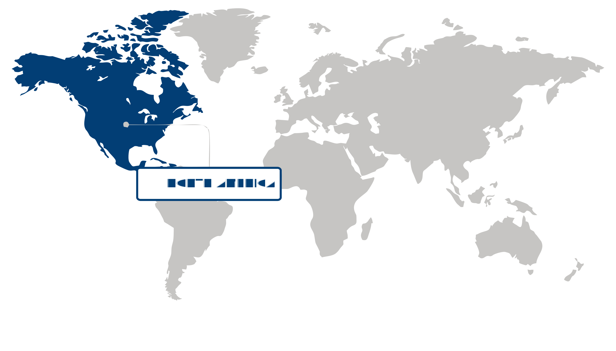
North America Market Statistics:
North America represented over 41.2% of the global satellite imaging market in 2025, establishing itself as both the largest region in this sector. The strong demand for satellite imaging solutions, particularly in defense and geospatial analytics, underscores the region's leadership. Factors such as heightened national security concerns and an increasing reliance on data-driven decision-making have catalyzed growth. Additionally, advancements in imaging technology and operational efficiencies have further propelled market expansion. Reports from the National Oceanic and Atmospheric Administration (NOAA) highlight the critical role of satellite data in environmental monitoring, reinforcing the region's commitment to leveraging technology for strategic advantages. As a result, North America presents significant opportunities for investors and strategists looking to capitalize on the evolving landscape of the satellite imaging market.
The United States anchors the North American satellite imaging market, driven by robust demand in defense and geospatial analytics. The U.S. government’s investment in satellite technology, exemplified by initiatives from the National Reconnaissance Office (NRO), reflects a strategic commitment to enhancing national security and intelligence capabilities. Consumer preferences are shifting toward more sophisticated imaging solutions, with private-sector companies like Maxar Technologies leading the charge in innovative satellite services. The competitive landscape is marked by collaborations between government agencies and private firms, fostering an environment ripe for technological advancements. As the U.S. continues to prioritize satellite imaging for both defense and commercial applications, its role reinforces North America's dominance in the global market.
Canada complements the North American satellite imaging market with its focus on environmental monitoring and resource management. The Canadian Space Agency (CSA) supports initiatives that leverage satellite data for sustainable development, emphasizing the importance of satellite imaging in addressing climate change and natural resource management. With increasing investments in satellite technology, Canadian companies are emerging as key players in the geospatial analytics space, catering to both domestic and international demands. This synergy between government support and private innovation positions Canada as a vital contributor to the region's satellite imaging landscape. Together, the U.S. and Canada create a formidable presence in the market, offering strategic opportunities for stakeholders looking to engage in the evolving satellite imaging sector.
Asia Pacific Market Analysis:
The Asia Pacific region has emerged as the fastest-growing area in the satellite imaging market, registering rapid growth with a robust CAGR of 13%. This impressive growth is primarily driven by the rapid adoption of satellite technology in China and India, reflecting a significant shift in demand as industries increasingly seek advanced imaging capabilities for applications ranging from agriculture to urban planning. The region's strategic investments in satellite infrastructure, alongside governmental support for technological advancements, further enhance its competitive landscape. As consumer preferences evolve towards high-resolution and real-time data, companies are focusing on developing innovative solutions that cater to these demands, thereby stimulating market growth.
Japan plays a pivotal role in the Asia Pacific satellite imaging market, characterized by its advanced technological capabilities and a strong emphasis on research and development. The country's commitment to precision agriculture and disaster management has spurred demand for high-quality satellite imagery, aligning with the broader regional trend of rapid technology adoption. Companies like NEC Corporation have been at the forefront, leveraging satellite data for urban development and environmental monitoring, as noted in their recent initiatives on smart city projects. This strategic positioning not only enhances Japan's market presence but also contributes to the overall growth of the Asia Pacific region by fostering collaboration and innovation in satellite applications.
China, on the other hand, is a powerhouse within the satellite imaging market, driven by its ambitious space programs and significant investments in satellite technology. The government’s focus on enhancing national security and environmental monitoring has catalyzed the deployment of advanced satellite systems, creating a robust demand for imaging services. Notable advancements by the China National Space Administration, particularly in Earth observation satellites, underscore the country’s commitment to leveraging satellite data for economic and social development. This dynamic landscape positions China as a leader in the region, reinforcing the Asia Pacific's status as a critical hub for satellite imaging innovation and investment.
Europe Market Trends:
Europe has maintained a notable presence in the satellite imaging market, holding a commanding share driven by its robust technological infrastructure and increasing demand for high-resolution imagery across various sectors. The region's significance is underscored by substantial investments in satellite technology and an emphasis on sustainability, which align with EU policies promoting environmental monitoring and disaster management. Recent advancements in data analytics and artificial intelligence are transforming how satellite data is utilized, enhancing operational efficiencies and enabling more informed decision-making processes. According to the European Space Agency, the growing interest in Earth observation data for climate change monitoring and urban planning is indicative of shifting consumer preferences towards more sustainable and data-driven solutions. Looking ahead, Europe presents significant opportunities for growth as companies innovate and adapt to the evolving landscape of satellite imaging applications.
Germany stands out as a pivotal player in the European satellite imaging market, characterized by lucrative growth fueled by its strong aerospace sector and a commitment to research and development. The country's focus on technological innovation is evident in initiatives like the German Aerospace Center (DLR), which actively collaborates with private companies to enhance satellite capabilities. This collaboration has led to the successful deployment of advanced imaging satellites, attracting investments that further stimulate the market. As reported by the Federal Ministry for Economic Affairs and Energy, the integration of satellite data into various industries, including agriculture and urban planning, highlights the growing consumer demand for precise and actionable insights. This positions Germany as a leader in the region, driving advancements that resonate with broader European trends towards digital transformation and sustainability.
France also plays a crucial role in the satellite imaging market, demonstrating moderate growth supported by its strategic investments in space technology and a vibrant startup ecosystem. The French government, through its space agency CNES, actively promotes initiatives that encourage innovation and collaboration among businesses and research institutions. The recent launch of France's Pleiades Neo satellites exemplifies the country's commitment to providing high-resolution imagery for commercial and governmental use. This initiative not only enhances France's competitive edge but also aligns with European goals for improved environmental monitoring and disaster response. The synergy between France's technological advancements and its regulatory framework fosters an environment conducive to growth, creating strategic implications for the region as it capitalizes on the increasing demand for satellite imaging solutions.
| Parameter | North America | Asia Pacific | Europe | Latin America | MEA |
|---|---|---|---|---|---|
| Innovation Hub i Scale Nascent Developing Advanced | |||||
| Cost-Sensitive Region i Scale Low Medium High | |||||
| Regulatory Environment i Scale Restrictive Neutral Supportive | |||||
| Demand Drivers i Scale Weak Moderate Strong | |||||
| Development Stage i Scale Emerging Developing Developed | |||||
| Adoption Rate i Scale Low Medium High | |||||
| New Entrants / Startups i Scale Sparse Moderate Dense | |||||
| Macro Indicators i Scale Weak Stable Strong |
Segment Leadership and Growth Trends
Satellite Imaging Market Share (%), Resolution, 2025
Go beyond the chart, access full insights & data tables
Request Free Sample ReportAnalysis by Resolution
The satellite imaging market for resolution is led by the high segment, which dominated the segment with a 49.5% share in 2025. This leadership is primarily driven by the increasing demand for detailed imagery, essential for applications ranging from urban planning to environmental monitoring. The preference for high-resolution data reflects a broader trend in customer expectations for precision and clarity, influencing competitive strategies among providers. Notably, organizations like NASA and the European Space Agency have highlighted the critical role of high-resolution imagery in scientific research and disaster response, underscoring its value in various sectors. This segment creates substantial opportunities for established firms to enhance their offerings while enabling emerging players to innovate and differentiate themselves. Looking ahead, the high-resolution segment is expected to remain relevant as advancements in satellite technology continue to improve image quality and accessibility, catering to the evolving needs of diverse industries.
Analysis by End-User
In the satellite imaging market, the commercial segment captured over 49.5% share in 2025, reflecting its dominance driven by private sector applications. The growing reliance on satellite imagery for commercial purposes, such as agriculture, real estate, and logistics, highlights a shift in demand patterns toward practical, actionable insights that support business decisions. Companies like Planet Labs and DigitalGlobe are at the forefront, leveraging satellite data to provide tailored solutions that meet the specific needs of various industries. This segment presents strategic advantages for established firms to expand their market reach, while also allowing new entrants to carve niches by offering innovative services. The commercial segment's ongoing relevance is assured as businesses increasingly adopt digital transformation strategies and seek to integrate satellite data into their operations for enhanced efficiency and competitiveness.
Analysis by Application
The satellite imaging market's application segment is led by geospatial data acquisition and mapping, which represented more than 31.2% of the market share in 2025. The dominance in this area is largely fueled by urban planning needs, as cities around the world seek precise data for infrastructure development and resource management. The demand for accurate geospatial information reflects a growing awareness of sustainability priorities and the need for effective land use, influencing both public and private sector strategies. Organizations such as the United Nations and various municipal governments have increasingly relied on geospatial data to inform policy and planning decisions. This segment offers significant opportunities for established firms to enhance their service portfolios and for new players to enter the market with innovative solutions. As urbanization continues to accelerate globally, the relevance of geospatial data acquisition and mapping is expected to persist, driven by ongoing developments in technology and data analytics.
| Segment | Sub-Segment | Largest Segment | Fastest Growing |
|---|---|---|---|
| Application | Geospatial data acquisition and mapping, Natural resource management, Surveillance and security, Conservation and research, Construction & development, Disaster management, Defense & intelligence, Others | ||
| Resolution | High, Medium, Low | ||
| End-User | Government, Defense, Commercial, Others |
Competitive Landscape and Market Positioning
Key players in the satellite imaging market include Maxar Technologies, Planet Labs, Airbus, DigitalGlobe, BlackSky, GeoIQ, Satellogic, ICEYE, Capella Space, and Spire Global. These companies are pivotal in shaping the landscape of satellite imaging, each contributing unique capabilities and innovations. Maxar Technologies, for instance, is recognized for its high-resolution imagery and robust analytics, while Planet Labs leverages its extensive fleet of small satellites to provide frequent updates on Earth’s surface. Airbus stands out with its strong presence in both commercial and governmental sectors, enhancing its influence. DigitalGlobe, now part of Maxar, has a legacy of delivering detailed satellite imagery, while BlackSky focuses on rapid revisit capabilities. GeoIQ, with its regional expertise, and Satellogic, known for cost-effective imagery, further diversify the competitive field. ICEYE’s radar technology complements optical imaging, and Capella Space and Spire Global are innovating in data accessibility and analytics, reinforcing their positions within this dynamic market.
The competitive environment in the satellite imaging market is characterized by a flurry of strategic initiatives that enhance the positioning of these key players. Notably, collaborations among companies are fostering innovation, with several firms exploring synergies that combine satellite data with advanced analytics. This trend is evident as players like Maxar and Airbus engage in joint ventures that expand their technological capabilities and service offerings. Moreover, ongoing investments in research and development are driving advancements in imaging technology, allowing companies like Planet Labs and BlackSky to enhance their product portfolios. The landscape is further shaped by mergers and acquisitions, exemplified by DigitalGlobe’s integration into Maxar, which serves to consolidate expertise and resources. These strategic moves not only bolster market competitiveness but also pave the way for innovative solutions that meet evolving customer needs.
Strategic / Actionable Recommendations for Regional Players
In North America, players could benefit from exploring partnerships with tech firms specializing in artificial intelligence to enhance data processing capabilities, thereby improving the accuracy and speed of insights derived from satellite imagery. Engaging with governmental agencies for collaborative projects may also open avenues for accessing funding and resources, enabling further technological advancements.
For those in the Asia Pacific region, focusing on integrating satellite data with local environmental monitoring initiatives could position companies as leaders in sustainable development efforts. Collaborating with regional startups to leverage emerging technologies, such as drones or IoT, can enhance service offerings and create unique value propositions tailored to local markets.
In Europe, companies should consider aligning with established aerospace and defense organizations to tap into their networks and expertise, which can facilitate entry into high-value governmental contracts. Additionally, targeting high-growth sectors such as agriculture and urban planning for tailored satellite solutions could yield significant opportunities, allowing players to differentiate themselves in a competitive landscape.
| Company | Market Share | Company Revenue | Revenue CAGR (%) | Product Portfolio | Geographic Presence | Innovation / R&D Focus | Strategic Developments |
|---|---|---|---|---|---|---|---|
| No companies available. | |||||||
Industry Development/News
| Company Name | Date | Key Development |
|---|
Explore This Report
Click a section of the wheel — or its numbered marker — to preview the custom segmentation, custom table of contents, or related reports available for this market.
Satellite Imaging Market — Custom Segments
| Segment | Sub-Segment |
|---|---|
| No segment data available. | |
Satellite Imaging Market — report.custom
| Custom Chapter | Custom Details | ||
|---|---|---|---|
| No custom TOC data available. | |||
Need a different cut of the data?
Request Custom ResearchWhat is the market valuation of satellite imaging?
What is the projected value of the satellite imaging industry by 2035?
Which part of the world represents the largest segment of the satellite imaging industry?
Who is driving the fastest regional growth in the satellite imaging sector?
Which is the largest sub-segment within the resolution segment for satellite imaging industry?
Why does commercial sub-segment dominate the end-user segment of satellite imaging sector?
How does geospatial data acquisition and mapping sub-segment fare in the satellite imaging industry?
Which companies dominate the satellite imaging landscape?
Our Clients
"The reports offered a comprehensive view of the Food and Beverage landscape, covering market trends, consumer behavior, and competitive dynamics."
"Our experience in acquiring market research reports has been outstanding — the depth of analysis and actionable insights have proven invaluable."
"Fundamental Business Insights demonstrated a keen understanding of our business needs, delivering reports tailored to our specific objectives."
Our Research Team & Methodology
Every Fundamental Business Insights report is built by a dedicated vertical research team, validated through a structured primary-and-secondary methodology, and reviewed for accuracy before it reaches you.
Research Team Overview
Prepared by the Aerospace & Defence Research Team
Delivery
Published
Demand
Available
Support
Trust & Compliance
Research Domains
10 coverage areasResearch Intelligence
| Source Category | Research Sources | Purpose |
|---|---|---|
| Government Publications | Government agencies, statistical departments, regulatory bodies | Industry statistics, regulatory insights, and policy analysis |
| Company Disclosures | Annual reports, investor presentations, financial filings | Company performance, business strategy, and market positioning |
| Trade Associations | Industry associations and professional organizations | Industry developments, standards, and market perspectives |
| Technical Literature | Research papers, technical publications, academic journals | Technology developments and technical validation |
| Patent Analysis | Patent databases and intellectual property publications | Innovation trends, technology activity, and competitive research |
| Industry Databases | Established research databases and market intelligence resources | Market benchmarking, historical data, and industry analysis |
Research Workflow & Quality Assurance
Data Collection
Verified information gathered through primary and secondary research.
Data Triangulation
Cross-validation using multiple independent data sources.
Forecast Modelling
Market estimates developed using historical trends and analytical models.
Analyst Validation
Findings reviewed by domain experts for accuracy and consistency.
Editorial & Quality Review
Final editorial, quality, and compliance checks before publication.
Final Publication
Released after successful completion of the internal review process.
Report Coverage
📊 Market Assessment
- Market Size & Forecast
- Market Segmentation
- Regional Analysis
- Growth Drivers & Challenges
- Market Dynamics
🏢 Competitive Intelligence
- Competitive Landscape
- Company Profiles
- Competitive Benchmarking
- Mergers & Acquisitions
- Market Share Analysis or Key Company Strategies
🔍 Strategic Analysis
- Value Chain Analysis
- Porter's Five Forces
- PESTLE Analysis
- Pricing Trends
- Supply-Demand Analysis
🚀 Future Outlook
- Technology Landscape
- Regulatory Landscape
- Investment & Funding Landscape
- Emerging Opportunities
- Future Market Outlook
Have a question about this report or need a custom scope?
Request Customization